
Hofsjökull glacier.
The volcanic silly season seems to be going strong now. And with silly season I mean miniature eruptions, unconfirmed eruptions, unconfirmed Jökulhlaups and so forth. These are of course interspersed with real eruptions and Glacier floods. Let us go through them.
Goðdali

Silted water in Goðdali. Picture from mbl.is
There have been reports of sulphuric smell and unusually coloured water coming out of Hofsjökull glacier towards the northwest. According to witnesses the water is containing silt or mud. There are no reports of an increase in the water flow as of yet, but the changes in color might mean that there is a Jökulhlaup on the way.
Hofsjökull is the largest volcano in Iceland that in any way can be called active. It has an 11 by 7 kilometer large caldera. The volcano has had early Holocene eruptions with formation of a shield volcano and basaltic fissures extending from the glacier. The highly hydrothermally active Kerlingarfjöll is also considered a part of the Hofsjökull volcanic system; it is though not situated under the Hofsjökull glacier.
The change in the water is most likely due to an increase in hydrothermal activity either inside the massive caldera, or in one of the fissures extending to the northwest.
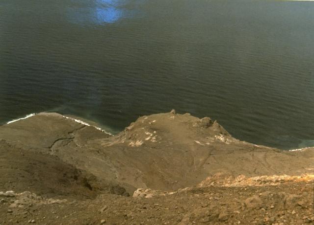
Kverkfjöll

Large ice caves is the end result after a Jökulhlaup has rushed out from a glacier. This is an ice cave resulting from a jökulhlaup from Kverkfjöll.
Activity continues at the Kverkfjöll volcano after the phreatic detonations that took place around the 16th of August. A few smaller earthquakes have taken place in the area, and a Jökulhlaup is still ongoing from the area. This is though not a significant Jökulhlaup and will subside as the available water drains out of the caldera.
Early in the morning today a 2.7M earthquake took place under the volcano at a depth that might indicate movement of magma at depth (9.1km).
Skaftá West Cauldron

The Western Skaftá Cauldron. Image by Icelandic Met Office.
The western cauldron that drains out into the Skaftár River is filled to the brim and a medium sized Jökulhlaup is expected at any time. The western cauldron normally suffers from smaller jökulhlaups compared to the eastern cauldron. The cauldrons are small caldera like structures at the Loki-Fögrufjöll volcanic system and the ice lakes are driven by strong hydrothermal activity.
It is slightly out of the ordinary, but not unheard of, that 3 different volcanic systems are suffering from Jökulhlaups at the same time. There though seems to be different driving forces behind them, at least as far as we know at this time.
Gunung Iliwerung
Out in the water lies the volcanic vent of Hobal. Image by Global Volcanism Program.
Iliwerung volcano is a caldera flanking somma volcano on the southern rim of Lerek Caldera on the Indonesian Island of Lomblen. The last sub aerial eruption of Iliwerung was in 1952, that eruption ended a period of heightened volcanic activity that saw 7 eruptions during 4 years. The phase started with an emplacement of a dome named Iligripe on the southern slope above the ocean in 1948.
In 1973 a new phase started at the volcano when a sub-aquatic vent named Hobal opened up and 3 small ephemereal islands surfaced.
Two days ago reports came that the vent of Hobal was once again erupting. On the 19th more than 180 earthquakes took place under the flank of the volcano at Hobal. Locals reported changes in water color and that steam rose in the morning of the 20th to a height of 1000 meters. Locals also stated that glow was visible.
I have a couple of big question marks on this by now widespread report. First of all, NVI has only raised the volcano from 1 to 2 on their scale (1 to 4) due to the earthquakes, but has as of yet not raised it further or published an official report on the eruption. There is also no evidence of an ongoing eruption from satellite imagery. The reports of glow from a the submarine volcano might also be a bit problematic.
Something tells me that some of our commentators will find out if this volcano is actually erupting, or not.
CARL


It said, “no comments” – Not anymore, hehe, *ah, and now reading post!
Yep, lets see if anything developes. Else rather quiet.
great post Carl.
One thing I haven’t told you, a secret, but when I did that travel in early August to the highlands near Hofsjokull and Vatnajokull, I did use my mind powers to focus in Hofsjokull and the northern part of Vatnajokull. The result: a couple weeks later, both Hofsjokull, Grimsvotn and Kverkfjoll show their signs of restlessness 🙂
Now seriously, I do think that this is not a coincidence.
Remember July 2011?
Within a week, 3 events occurred and similar to these: In the space of a week, Katla has a jokulhlaup and mini-eruption, Hamarinn has also a jokulhlaup and mini-eruption, both with significant quakes and large tremor, before these Hekla had a larger quake and an alert for a possible eruption was placed but nothing else happened.
Now, 3 other volcanoes show their signs of activity almost at the same time.
My explanation: a new hotspot pulse, that creates intrusions of fresh magma under several volcanoes at same time. They respond by increased geothermal heat and following flood.
As you know I share the idea of a new magmatic pulse. But… Problem is that except for the epidemic of deep earthquakes there is not a lot to support it. At least yet, so I try to avoid talking about in the posts while I quietly whitle away on finding more evidence.
islander: i saw your link, yes, Hamarinn seems to be putting really steep inflation, and this has already been occuring for at least some 10 years. Add many almost daily deep quakes, and this seems to be a volcano on verge of a major eruption. (Askja is another very close to eruption, kind of volcano)
Do not forget Herdubreid. That one has once again started to suffer from deep earthquakes, a sign of yet another wad of magma moving upwards into the system.
My biggest surprise was a couple of deep ones under Godabunga, that one has not had a new emplacement since the early nineties.
I am up now to 10 different spots that has had those deep earthquakes.
I wonder how much more Hamarinn can take with that much inflation.
There is really no way to tell.
Only thing we can say is that sooner or later something will happen.
Currently there is not much pointing towards it being immanent, but that can change in short time. I think we though would see an increase in earthquake activity for a couple of weeks before an eruption would start.
Well, if we start seeing magnitude 3+ quakes, we’ll know our answer.
Remember that Eyjafjallajökull saw almost no quakes that strong. I would guess we would see more small than a few larger.
Ah okay. Did not know that.
Eyjafjallajokull had 2 months of daily quakes, but most M1 to M2, deep, then less deep.
This has been happening at Hamarinn for a long time already.
Before Eyjafjallajokull eruption, there was a sudden and sharp movement in the GPS, both upwards and laterally, but that region is highly monitored compared to Hamarinn.
Hamarinn is probably more like Grimsvotn. Continuous and sustained inflation until it goes. Therefore, we might not have a clear warning before any eruption.
I reckon the same goes for Kverkfjoll. This event has a few quakes associated with it, but it barely got noticed. Just like Grimsvotn before its eruptions.
All these Icelandic volcanoes seem much more tricky than I thought!
Hi Carl
thanks for this update on the situation. I’ve read elsewhere that Tolbachik was still erupting albeit maybe the end draws nearer (but this can only be logical !).
As for Iliwerung volcano I see nothing on yesterday modis. No Mancha.
Culture Volcan has a post about Iliwerung with MODIS images with possibly showing pumice rafts on August 20th.
http://laculturevolcan.blogspot.gr/
to my eye they are clouds…. and they are far away from the actual volcano spot. Also there is no discoloration of the waters….
Yes, and having sailed in the area…
There is no honking way in hell that a pumice raft could have drifted that far. Neither wind, nor currents could do that.
(The current would actually move it to the east)
Interesting, you can’t really find anything about the Lerek Caldera. It must be quite ancient as it doesn’t seem to stick out on Google Earth in any given way, which would imply that it’s old enough to be eroded so much as to leave very little of it’s existence visible.
I think the activity at Hofsjökull is the most interesting of all these, if only for the fact that it’s a much more mysterious volcano than any of the other volcanoes showing activity. More than just that, Hofsjokull has many elements that make you leary of what it could do if it were to erupt.
-Large Caldera with voluminous Ice cap to supply water in the event of an eruption..
-Subsequent nested calderas that show repeated history of large eruptions
-Ryholitic Signature in many areas of the volcano, indicative of explosive potential
-Very long repose time after last eruption, with little historical information to go off. This theoretically gives the system more time to accumulate and evolve magma.
-Very large geothermal field with the largest fumarolic field in Iceland is indicative of vast heat source at what would presumably be a somewhat shallow depth.
Now, I think it’s very unlikely that we would see an eruption here, and even if there was a Hofsjökull eruption, it would most likely be more of the traditional Icelandic basaltic effusive style. With that said, if I were an Icelander, this would be one of the volcanoes I would least want to erupt. Thankfully, it’s at least very remote in the event of an eruption.
Hofsjokull is also little monitored, and most important of all, it has an outlet river, the Thjorsá, that goes down towards the lowlands, near populated areas.Langjokull outlet river called Hvitá, also runs through populated areas, including my home!
These two volcanoes are not something we want to erupt. Most likely, eruptions there would be large. They would be a big ash cloud if inside the caldera, or a large lava eruption if outside the caldera.
It is funny, that a few weeks ago, I experienced what came on the news as the largest thunderstorm for ages in Iceland, and it started right above Hofsjokull. When I saw it, I couldn’t stop to wonder that it looked a bit like an eruption of Hofsjokull. How ironic would it be, if Hofjokull would really erupt, having myself experienced such an interesting “sign” (if there is such thing)
The 2.7 at Kverkfjöll looks like an Isolated one though. Not a grouping of them.
BTW: When was the last time Hamarinn had a good sized eruption?
No idea. Not for a very long time. Or if it was, it was a ashy and inside the glacier, therefore it got lost in the record of eruptions, as ash profiled in ice cores.
But nearby there is the Veidivotn region, with major events in 1477 and also another considerate event further northeast in 1862.
The GVP has clumped together 3 different volcanoes (at least 3), namely Loki-Fögrufjöll, Bárdarbunga and Hamarinn. The last eruption from the system was at the eastern caldera of Loki-Fögrufjöll in 1910.
To answer your question. There have been no known eruptions at Hamarinn in Holocene times.
Regarding the much waunted uplift at Hamarinn, there is no reason to believe that it is actually taking place at Hamarinn. There is an equal chance that we are talking about it being activity at Loki-Fögrufjöll and that the uplift is much larger since it is further away.
During the last 25 years there have been at least 11 events that have been either very minute eruptions, phreatic detonations or large hydrothermal events taking place at Loki-Fögrufjöll. My guess is that we are more likely to see an eruption there. The activity has been alternating between both calderas of Loki-Fögrufjöll.
To really confound things… Hamarinn could be an extension of the much more active Loki-Fögrufjöll volcanic system, and that might also explain the uplift at Hamarinn.
On SakuraJima, which has been highly interesting in the past few weeks.
Boris posted an interesting link to a PDF on historical inflation of the system. http://www.bristol.ac.uk/cabot/documents/iguchi.pdf
It’s interesting to note that despite what seems to be an increase in eruptive activity, inflation has continued, and arguably increased since 1948. So while the frequent Vulcanian eruptions that have been occurring are magnificent, they are not very effective in acting as a pressure release valve for the volcano, and it would be prudent to assume that it could be heading towards another eruption in the VEI-3 – VEI-5 range (similar to the 1914 eruption) at some point in the next 1-2 decades.
There are calderas and there are calderas but not all “calderas” are calderas, especially the Icelandic ones that most likely were formed by subglacial processes and not, definitely not, “caldera-forming eruptions”.
That said, Hofsjökull is interesting because it is a very large volcano that has extensive areas of rhyolite extrusions, proper caldera-type structures as cbus points out and has had a very long repose time with no known eruptions. With an ice cap 600 – 700 m thick, that is not surprising as it would take a very determined, explosive VEI 3 to break through the ice cap, so for all we know, there can have been quite a few, small “Katla 2011” or “Fimmvörduháls 2010” type eruptions that have passed unnoticed except for possible hlaups – and even those may have passed more or less unnoticed as the area cannot be said to have been densely populated during the past 1000 years.
Still, if these are indeed early signs that Hofsjökull is beginning to wake up, we could still be many hundreds if not thousands of years away from an eruption as what magma there is has had some ten thousand years to cool down and will need a humungous infusion of fresh, basaltic magma to heat up to the point of an eruption. Even at 1,000,000 cubic meter per year (VEI 1), it would take a thousand years for a 1 cu km infusion, and my guess is that it would take much more than that.
But then again I could be wrong and we could witness a Hofsjökullatubo eruption or even a Nibiru event before the decade is out.
Problem is that only 1 magmatic emplacement out of 10 causes an eruption in Iceland. There is actually nothing that would have prevented Hofsjökull to have had a fair-sized emplacement every 50 years or so.
I am not saying that it is the case, but the vigorous hydrothermals in the system kind of point to large amounts of heat being readilly available in the system and obviously it has not erupted.
If no new heat had been inserted into the system it should have cooled down in the last few thousand years.
Will we see Hofsjökullatubo? Not likely really.
It’s very similar to Torfajökull which also has an active geothermal area close to a massive rhyolite extrusion. I quite agree that Hofsjökull could, and actually must have, substantial magmatic emplacement geologically quite regularly but alas, the main magma chamber(-s) must have solidified beyond the point where it / they can be remobilised. For Hofsjökull proper, the most likely scenario are small, subglacial basaltic eruptions Far more likely would be the Kerlingarfjöll area to evolve an progressively create a larger magmatic system until it begins to erupt as a central volcano in its own right.
Bardarbunga and Torfajokull could clearly shows us what can happen with Hofsjokull. All 3 seem to have largely partially solidified/ crystalized magma pools.
Bardarbunga solved the problem easily. Magma pops out in Gjálp, or further southwest along Veidivotn. And it is the large volume of fresh hotspot magma. Ocasionally, small eruptions occur within the caldera, but they are small.
If Hofsjokull would behave similarly, then a large fissure would open somewhere towards the sides of the Hifsjokull caldera, even at Kerlingarfjoll. Ocasionally, a small eruption could occur within the caldera. It could receive a hotspot influence, but less than Bardarbunga or Grimsvotn.
Torfajokull also has occasionally small eruptions within its caldera, and since it is further away than Veidivotn, it is even less likely to receive such a large emplacement, but in theory it could, and within a short period of time.
In what do you base such rate 1000000 cubic meter per year?
Grimsvotn erupted a nice0.7 cu km in just a few years after its last eruption, and apparently near all that magma was fresh!
Hofsjokull is quite closer enough to the hotspot to be possible to suffer such a sudden fresh infusion and enough to trigger an eruption within a few years.
but yes many eruptions could occur beneath the ice cap. If they occur, we will probably detect tremor and a few quakes.
Guesstimate based on the typical amount of the average infusion/eruption of basaltic magmas for Icelandic volcanoes not directly over the hotspot. If you take Eyjafjallajökull as an example, she’s had four eruptions over the past 1,000 years totaling less than ½ cu km DRE which corresponds to ~500,000 m3 per year. It took Askja about 10,000 years from the previous VEI 5 in 8900BC to build up for the 1875 one which, if you allow for the intervening small eruptions give a similar ballpark figure.
Grimsfjöll/-vötn is a very special case and seems to have a contract with the hotspot that guarantees it 50% af all fresh magma produced.
Problem is more that it took Askja 10 000 years to rebuild the magma chamber.
You just can’t do averages like that. Volcanoes do not get steady influx of lava in Iceland (with exception of Grimsvötn). It comes in pulses.
Also, the amount of magma a volcano can receive before erupting increases as time goes for the more active ones, and oddly enough the eruptions seem to come as frequently or even more frequently, and somehow even the magma production rate increases under a volcano going down that road. Cycle ends with a big eruption. There is nothing saying that a large volcano instead of having frequent eruptions could not have frequent magmtic emplacements filling the same function of enlarging the magma chamber.
Ok, Eyjafjallajokull has around or a bit less than 0.001 km3 per year. And Askja, Krafla, and other volcanoes in Reykjanes seem to show similar rates of intrusion until an eruption.
But there is at least one exception:
What about Hekla, about 0.1 km3 in 10 years.for the past decades. However in past centuries, Hekla had averages more near 0.01 km3 (up to 1 km3 per century).
Or Katla which has a lower average, about 1 km3 per century, or 0.01 cu km3 per year, still 10 times larger than Eyjafjallajokull (but also has a 10 larger area)
Dead zone volcanoes, like Veidivotn, 10 km3 about every 500 years, this is about 0.02 km3 per year. but there we can agree that they are fed by the hotspot.
We could settle for an average 0.001 km3 per year for most volcanoes, but 10x more for the dead zone and Katla, and 100x more for recent Hekla activity. Grimsvotn has a similar rate to the recent rate of Hekla.
This actually makes up for excellent prediction.
time since Hofsjokull last one: 10.000 years
let’s assume a rate 0.01 km3, because of its proximity to the hotspot
let’s assume also that Hofsjokull suffers about 10x less intrusions that most volcanoes
this still gives a nice 10 km3 picture, for its next eruption, the potencial for a VEI5-VEI6 eruption
Let’s say Krisuvik next eruption
time since last eruption: about 700 years
rate 0.001 to 0.0005 km3
next eruption: 0.35-0.7 km3, potencial for up to VEI4 (but probably mostly efusive)
Let’s say Askja
time since last eruption: 50 years
rate 0.001 to 0.01 km3 (its near the hotspot)
next erupton 0.05 to 0.5 km3, or VEI3-VEI4 (but most likely mostly efusive)
Lets say Katla
time since last one 100 years
rate 0.01 km3
up to 1 km3, VEI4+ to VEI5
Or Theista, favourite for Carl
time since last one: I can’t remember but something like 5000 years
rate 0.001 km3
a nice eruption of 5 km3 lava
“Hofsjokull is quite closer enough to the hotspot to be possible to suffer such a sudden fresh infusion and enough to trigger an eruption within a few years.”
No! Compare it to Torfajökull, another volcano that has had a very long repose time since its last, caldera-forming eruption and one with geothermal areas as well as extensive rhyolite extrusions. Torfajökull is known to have a magma chamber containing about 4 cu km of magma which has solidified to the point where it is considered to be non-eruptible and in order to remobilise this to the point where an eruption would occur is definitely not a matter of “an eruption within a few years”. Work out the maths! With an infusion rate of 0.001 cu km of 1200C hot magma per annum, how long would it take to raise the temperature of a Rhyolite mass of 4 cu km at 400C to an eruptible 800C? A few years? Fiddlesticks!
I should modify that “No!” – If you could convince me of a process that would guarantee Hofsjökull the identical amount of fresh magma injected into Grimsfjall (0.1 cu km per annum), I would accept that Hofsjökull might be only be some 50 years away from an eruption.
But first you would need to convince me of a process whereby either the magma injected at Grimsfjall is diverted to Hofsjökull, or, an identical hotspot appears to inject directly into Hofsjökull.
Actually yes.
there was a study of the hotspot plume topography, it has a wide head about 100km acros (so that just includes Hofsjokull), but more interestingly than that, the authors in that paper (which I have read but frequently forget the link to it) say that the plume has an “arm extending towards the north, another arm extending towards the southwest, and another arm towards the west, directly over Hofsjokull and Langjokull.
So, yes, fresh hotspot magma can be directed (not diverted) towards Hofsjokull, just like it did during Laki or other dead zone volcanoes.
And why 50 years? Hofsjokull could easily have had 5 periods of 10 year of intrusions during the previous 10.000 years. Why not?
The Laki region (or the Edlgja) have not erupted since thousand years, and then within months, they did erupt. The flux of magma was too overwhelming and impressive. Same can occur for Hofsjokull.
However averages are averages, I agree with Carl, and these processes are still poorly understood.
by the way, Torfajokull did erupt in 1477. A small eruption but it did. The fresh magma that triggered came from Bardarbunga system (fresh hotspot magma). We only need the entire 10 km3 of 1200ºC fresh magma to get into contact with the 4km3 of 400ºC cooled magma to raise its temperature to 800ºC under Torfajokull, to have such a massive eruption there. These are the maths. Iceland has no regard for limits, if the hotspot sources it.
Remember Torfajokull is just 10-20km away from where those 10km3 of fresh magma erupted in 780 and 1477 eruptions in Veidivotn!
I think you will have to go and find a horse to shave the tail off for those fiddlesticks…
The number of 0,001 km^3 is just a grab out of the air. Let us take a look at Eyjafjallajökull. E is further away from the hotspot that Hofsjökull and have never been a direct part of the Hotspot volcanism whereas Hofsjökull has been situated directly ontop of the Hotspot.
E had two known magmatic emplacements, and it is highly doubtfull that E had one between 1873 and 1999. We know that E erupted 1 km^3 of tephra DRE plus probably about the same in the form of Lava. Ie, 2 cubic kilometers of ejecta. Normally about 1/10th of the magma emplaced is coming out as ejecta, and I see no reason to believe anything else happened at E. So, we have 20 cubic kilometers of magma emplaced between 1999 and 2010. Or, about 2 cubic kilometers per year. That is not a fiddlestick…
To really confound things. It was not done at a steady rate, it was done in two pulses. The first was smaller, probably in the region of 4 cubic kilometers during the span of a couple of weeks. And the second was about 16 cubic kilometers during a couple of months. None of this came from the hotspot per se.
Back to Torfajökull, part of the volcano is contracting due to cool down, but another part is actually inflating in bursts with about 10 long period earthquakes per year. The contraction quakes are about 2-5 km depth and the LP quakes at 10 – 15 km depth.
What can we learn from this? Well, that the volcanoes close to the hotspot (Grimsvötn) accumulate at an increasing rate at least 1 cubic kilometer per year (more likely 2 to 4 km^3 now) and that the further off volcanoes can amass huge quantities of magma in very short time.
Remember that Laki produced a whopping 150 cubic kilometers of magma within a few months, all of it fresh newly produced magma.
I would not rule out anything happening really… doing that would just sooner or later place a fiddlestick in my derriere.
Ahem…
Small problem with my numbers here…
Move the decimal coma appropriately for all volcanoes except Laki, that number is correct.
E erupted 0,2km^3 of combined ejecta. And thusly had 2 cubic kilometers of combined magmatic emplacement. Do the same for all others.
Carl, your 2 cu km magmatic emplacement is a grab out of air. No doubt you base it on the fact that only one in ten emplacements leads to an eruption, but that is an error of logic. We *know* the extent of inflation of E from 1994 (1996?) to 2010 and from that a volume can be calculated that corresponds to the amount subsequently erupted.
If you were correct, WHERE has those 90% not erupted gone to? Why didn’t they show up as deformation, i.e. uplift? And if there was an intrusion that great, why didn’t it show up as inflation? Lady E would have had a maximum uplift of 75 cm, not the 7.5 cm actually measured if you were correct. Hehe 😛
Eyjafjallajökull is ontop of a fissure, as with every other volcano in Iceland that erupts it widens the fissure (rift) during an emplacement. So, you are erroneously only counting 1 dimension out of 3.
As magma moves upwards it form a wedge shaped dyke widest at the bottom and narrowing as it goes upwards. As the fissure/dyke happens a void would be created, but since nature abhors voids it is instead filled with magma. Only the top portion of that magma column is ever erupted.
Think about it. After all, Icelandic volcanism is spreadvolcanism, not subduction volcanism.
Hehe!
Carl, the total DRE erupted by E was 0.14 cu km since which the ground has deflated to its pre-intrusion levels. If your figures were anywhere near correct, the Eyjafjallajökull eruption would be FOUR TIMES that of Mt St. Helens! You must have misplaced a few decimal points there my friend! 😉 Even if I give you that the total amount injected is twice that of the inflation, the total amount injected over the past 1,000 years only comes to an *annul average* of 0.001 cu km. It’s not a grab out of the air, just go and skull up on the 920, 1617, 1821-3 and 2010 eruptions!
My fiddlesticks stand. 😛
Note my little addendum about the sizes. I had a decimal error.
But, your fiddlestick still has a bit of work to do.
You are making a standard mistake. People believe that an volcano is what is visible on the surface. It is not. 9 out of 10 emplacements creates no eruption. Every emplacement that leads to an eruption normally only eject 1 tenth of the magma as lava. So, only 1 percent of all magma emplaced actually ejects as lava. If you think about it you will see, Iceland is not built top down by lava squirted ontop, it is built by magma emplaced in the rifts at depth.
Nope, the figure of 0.14 km^3 of DRE is only for the tephra equivalent. The lava is not counted in.
Now back to Mt Saint Helens. You do know that most of the DRE was not magmatic? Most of the waunted VEI-5 eruption was just sand and gravel from the collapsing side of the volcano. I seriously doubt that the emplacement was larger than tops 1 cubic kilometer. And that is less than what happened at Eyja. Drumstick on that one 😉
And your averages has no bearing. Remember that most of the magma emplacements are new fresh magma being created and rising in short period of time. So any averages are just pointless to even talk about.
Let us look at Theistareykjarbunga. It did nothing for a minimum of 140 years. No inflation at all. Then back in 2008 it roared back into life with two massive emplacements. Then quiet… Only thing we learned from that is that there is a chamber down there that can take a lot of magma in short time. This from a volcano thought to be extinct.
“So any averages are just pointless to even talk about.”
Sorry Carl, but that is BS. They are a measurement of the ENERGY influx into a system over time and when – as you yourself point out – only one in ten emplacements results in an eruption, the measurement of energy input over time becomes critical. Energy cannot be destroyed. It can either transform/change state or dissipate. Lurking has shown us that the timescale for energy dissipation even for a very narrow intrusion such as Godabunga is a process that takes thousands of years.
“You do know that most of the DRE was not magmatic? Most of the waunted VEI-5 eruption was just sand and gravel from the collapsing side of the volcano. ”
Immaterial. The ENERGY required to pulverise that rock, even that which transformed solid rock into clay over thousands of years which led to the ultimate instability, and send it more than 20 km skywards and 50 km sideways (rocks the size of fists riddled cars at that distance), came from successive magmatic emplacements over a period of hundreds of years (probably long before the 1800-1857 eruptive period) until the critical point was reached. That ENERGY was what powered the St Helens VEI 5 eruption.
Sorry, it is not BS.
You are making a statistical model of energy influx into a volcano. You are saying that a 100 watt bulb is getting an average of 1 watt per day untill it flashes for a day every 100 days…
We know that the volcanoes normally receive lava intermitently in the form of pulses. So the energy input is also intermittent.
Saying that energy mysteriously enters at an equal rate is just not conforming to actual data.
Sorry again, dissipation does not equate accumulation, the formula is not mirrored like that.
Snicker, you do not even believe that yourself Henrik. The accumulation of a complete stratovolcano in the form of Mt Saint Helens, and you compare that to magmatic emplacements? Get real.
Carl, now you are deliberately misconstruing what I’m saying in such a manner that I begin to doubt that further discussion is meaningful at this point. Let’s just leave it there! You’re probably suffering from jet lag and I’ve had my second chemo today so we’re probably not at our most magnanimous and open-minded.
islander, and remaining Icelanders: this interesting event at Hofsjokull could be further explored. I followed the path of the river having the sulphur gas, it comes from the NW corner of Hofsjokull, near its main caldera.
There is another major outlet river coming from there, called Blanda, that runs just east of the Kjolur road, and even passing just by the road, according to the map.
If one would drive the Kjolur road, just before Hveravellir (to its east), one could check that river for signs of increased flow or sulphur smell. Sadly I am abroad and I cannot drive there, because I would if I could.
Hveravellir SIL http://hraun.vedur.is/ja/oroi/hve.gif , the closest one to NW corner of Hofsjökull. Five-six days ago there was some recorded activity – similar to that has been constant near Hekla Volcano (i.e. “fed” SIL http://hraun.vedur.is/ja/oroi/fed.gif) but my best question is what happened six days ago? Did something change?
I do not belive in specific “hot-Spot” pulses per se. And both only in summer? More like pressure-relief as snow-melt, but as activity is high these decades, more heat could have entered Hot water systems. I think hofsjökull is not on verge of eruption, I think Langjökull / Prestahjúkur / Ok Volcano be closer. Yes, there is volcano named Ok. No kidding.
Thank you for Ok!
When I say hotspot pulse I mean the long cyclical trend up and down, not any short term thing. As you know we have intersecting hotspot pulse and rifting period coming up, so when I say hotspot pulse I am talking about something that has started to build up and will culminate somewhere between now and 2050. Ie, the big poop.
You are velcome to Ok! Ok, I understand is a Dyngja west of Langjökull.
But I think Hofsjökull having normal Glacial flood due summer melt. If there was anymore coming there whould be some unrest. This will show soon if it happens.
The rifting can start any day. It may already have started “in certain aeas” known having reverse drift or spread, some areas in the interior, in Veiðivötn or Langisjór etc.. Any erupton under Langjökull or Hofsjökull can have very serious flood effect on roads and the telephone network. Electricity is less affected.
Islander, Prestahnukur has had several swarms in recent years, some quakes alsoat Skjaldbredur. So I think you are correct, Langjokull system seems also to be heading somewhere.However due to few signs, I still do not worry much about it.
Yes, I know, of course. Been watching IMO on Internet for last eight years. Including swarms here and there and find this period now “be as calm before the storm”.
So have become fairly well versed in reading the graphs. Do-ing-so, I read them signs for Eyjo (14 April 2010) eruption well before it erupted, much earlier that night. That time the clock was 00:30, annoncement came over radio at 01:10, followed by actual observation of steam looking clouds (eruption clouds) before 07:00 in the morning, at same time they were reported by passing airliner (B-737 of “Iceland Express”).
The flood came only after 10:00 hrs local. So you see Glacial eruptions do have well observative steps, so I am not worried.
I am seeing vague similarites now at some SIL´s, particularily FED (Fedgar) before six days ago, then it changed. Does this “quieting” mean Hekla is ready to blow (as has ot reached it stretching limits?) http://hraun.vedur.is/ja/oroi/fed.gif
“big poop”, that’s a nice word Carl!
What will it be this time?
Veidivotn? Hamarinn big one? Hofsjokull or something unexpected? The awakening of Krisuvik? Herdubreid? Oraefajokull or Kverkfjoll? Hekla going caldera? What’s your bet?
Trouble is, I would really like to know what happened circa 1700-1780. Was Laki ocasionally experiencing earthquakes then, or only shortly before the eruption? What about before the Oraefajokull eruption, was it behaving like Askja or Herdubreid is now?
The currently restless volcanoes could perhaps provide us with clues to which will be the next big ones, the next big poop
My guess is either Veidivötn or Askja fissure swarm. And droves of odd volcanoes erupting. But, I will write a post on it one of these days.
Carl found photo of eruption 1963 near Geirfuglasker.
Incoming in your mail …….
Sorry, wrong Geirfuglasker – Its Surtsey actually.
In your box anyways.
It would have been the holy grail of eruption photos… 🙂
But the wrong Geirfuglasker is also coolish 🙂
Tyler posted a rather interesting picture of inflation at Hammarin on the Facebook Eruptions Team:
Up 100 mm since June 2011, 50 mm North and oscillating wildly (+/- 10 mm) E – W over the past few months.
And if one take into account that it is not fixed for yearly isostatic rebound it is not that specacular. HAFS suffers from 25mm of it… It is very bouncy.
Here is the link for the last 3 months.

If we instead look at the continuous SKRO instead we can easily see the same bounces very clearly. Here we have real uplift. Oddly enough that uplift is further away from Hamarinn and is still much more distinct.

And once again the link to the place with all the GPSes.
http://gps.vedur.is/mapGPS.php
Skrokkalda – omg! Correct me if I’m wrong, but not even Grimsfjall/-vötn does that!
No… that is something far more ominous potentially.
As the plates separate the rift will thin and magma creates due to pressure relief. As the magma is created it increases the pressure upward of the rift, and it parts some more, more magma is created… And after a while you get a bulge running down the entire rift.
You catch my (d)rift.
Still, 360 mm is nowhere near sufficient for the scale we’re imagining if we take the values from Monte Nuovo and Rabaul, 6 m, as a ballpark figure.
Yes, but we do not know when it started… And also, we know from my Laki excercise that the bulk of the magma is created explosively as the rift tears… Only question is when it tears, not if. Now sleepy time, have a date with a dead leg in the morning.
One almost OT comment. Sorry Carl, could not help it 😉
Mentioning date with a dead leg … “To take someone on a Leg” (Icel.: “taka einhvern á löpp”) – explained from Icelanders point a view – it means “an defininte pickup” – to get someone into bed, to be laid, but (that person) does not have to be “dead” drunk, but it shure often helps!
Yes, also here in last thread.
Does not have to be worrying despite that.
All of Iceland is rising, except the economy of course.
“All of Iceland is rising”
Upptyppingar?!?
And Geirvörtur!
Höfn is though being a submarine. Actually, all of Iceland is not rising. The western side is sinking. And well, Höfn. (bradyseism be thy name).
Icelandic is to my knowledge the only language known on the planet that has a word for that special symptotic reaction to emplacements of that kind in that oratory tract. It is very refreshing.
Rising by every means: post-glacial uplift and hotspot magma.
The recent accelerate melting may eventually trigger eruptions in places we do not commonly expect, within the next decades or centuries, just like 10000 years ago.
Reykjanes is a potential “nasty”. While a Skaftar Fire is most likely out of the question, a Krafla Fires would be quite devastating. Beginning under that lake near Krisuvik…
I think such an eruption would be still smaller than a glaciated volcano. That lake is just a few meters deep, while the other volcanoes have hundreds meters thick ice. Much more water there.
Still it is very near Reykjavik to cause trouble. Not so much the ash (it would be similar as for instance the eruptions around Quito), but for the lava would approach its suburbs, but this lava fight is nothing new for icelanders.
Henrik… I am fairly certain that we will have a Skaftár somewhere between now and 2050. Something to sleep on…
Yes, all of *Central* Iceland is rizing. Sorry for inclarifying (fuddling) that.
Tonight has had very much debates. I need read all this again tomorrow, to digest all fully.
Well, time for me to go to bed… Must get up and look at the hungover crowd and do some studying.
Hell week…
It has gotten a new meaning for me. Part 1 is looking inside of dead people to whittle away those to squemish. Part 2 is getting really drunk every evening, something that I leave to the youngsters.
Remember that when you see a doctor the next time. He or she will have either been drunk or gloriously hungover 1/5 of the time during their entire studies… At least here. In the words of Danny Glover, “I am to old for that shit” so I go sober and actually read in the books.
It’s not like you spent most of the weekend and two days prodding at stuff inside a problematic laptop.
I found out today, that the issues with this laptop started when it fell off the back of a motorcycle doing 112 kph (70 mph). Then it was repaired. Lightning then killed it. (not a dead strike, the EMP on the Ethernet took it out. I’ve seen the results from dead strikes… nothing like that inside). This issue was it not powering up. The IT Point of Contact referred to it as a Peice of Shit, but considering what it’s been through, I think it has held up rather well. I delivered it to it’s user today, only to find out that he wont’ be back for a couple of weeks. He was dispatched out to Idaho to assist with the fire they have going on out there.
They are not having fun in Idaho Particularly Hailey/Sun Valley.Too hot too dry. Not unusual,
but happens every so often, Our turn is coming here in NE Oregon Dry Lighting tomorrow and
Friday..
stay safe 🙂
Sakura-jima is still coughing away. What is “odd” is that the pressure is not dropping much as the fumerole to the left of the Showa Crater is still going strong:
http://webcam-svo2.pr.kyoto-u.ac.jp/local/camera.html
Sakurajima is complex. There’s more than one active vent in the Showa crater – four, I think I read – and they don’t all erupt in every eruption. Usually it’s just one vent that goes. I saw that quite clearly when I was there.
There’s pressure and there’s pressure. SJ erupts constantly – but IIRC the centre of the Aira caldera is still rising. Resurgent doming? I agree with others I’ve read; SJ could do something much bigger in the not too distant future.
Remember, last time SJ erupted big-time, the *centre* of the caldera subsided, not the Sakurajima edifice; it’s plumbed in to the main magma reservoir. (I dislike ‘magma chamber’ for obvious reasons)
“I quite agree that Hofsjökull could, and actually must have, substantial magmatic emplacement geologically quite regularly but alas, the main magma chamber(-s) must have solidified beyond the point where it / they can be remobilised.”
How are you so certain that the primary magma chamber is solidified beyond remobilization? Rhyolitic eruptions always seem to have very long repose times between eruptions, and from what I understand, will often sit waiting for a very long repose time before they remobilize with a fresh basalt injection. See Cordon Caulle, Novarupta, or most of the Taupo rhyolitic eruptions. Also, I actually just read an article mentioning how silicic magma chambers can actually stay around without cooling much longer than people realize. Now add in a constant influx of new heat, and I think it would stay hot.
My point being, unless there is some method that I have yet to learn about (which very well may be the case) I think it’s very presumptive to assume any magma chamber with large active hydrothermal fields has cooled down past the point of eruptability.
If fresh diapirs of magma are added to a magma chamber after rising from the hotspot at a somewhat regular rate, it wouldn’t be that difficult to believe that those diapirs of basalt could keep a large rhyolite magma chamber hot for an indefinite amount of time (or until the ceiling can no longer hold back the pressure rather).
After all, this was most likely the process by which previous caldera forming eruptions occurred at volcanoes like Hofsjokull and Torfajokull, so it would be naive to believe that this wouldn’t happen in a loosely cyclical fashion.
I’m with cbus20122 on this one and disagree.
Here is a simulation run using Heat 3D. There is a lot of artificiality in this, but I think it represents the problem with the idea of “must have solidified beyond the point.”
First, the problems with this simualtion.
1) The specific heat of the country rock used in the model is 980 J/kg K. It’s actually closer to 840 J/kg K.
2) The Geothermal gradient defaults to 20° C/km. I don’t know what it actually is for that system.
3) How long ago the last significant eruption was is not listed in GVP, so I just ran the simulation out to about twice the length of the Holocene
Even wtih those vagaries in the model input, you could still have a significant amount of easily mobilized material in the residual magma chamber… after 24,000 years. Slowly fractioning out and becoming more silica rich.
And the most important vagary… my simulated chamber is 6km wide and 2.7 km tall, centered at about 4 km depth. In other words, a pretty big chamber with a lot of thermal inertia. That black line extending down represents the dike intrusion that fed the system… though much cooler, it is still just above the solidus. The one I used was about 0.75 km across. Mafic 1250°C magma.
IMO, it could still be a pretty fluid slurry down there after 24,000 years.
In other words, it would not take much to kick that system into an “on” state.
This simulation was run on K Ware’s “Heat 3D”. A geophysical heat flow simulator for magma chambers. This run is essentially a generic chamber.
Yup, WoW! I totally agree there likely is LOTS of melt down there. The fact that eruptions have sprung up in very old systems (like Snæfellsnes, Eldborg – before Columbus sailed for the new world) gives impression there might be hork more lava than the 90% leftovers. Despite what Carl said earlier, Iceland IS built from layers upon layers of lava. The Spreading rate indicates it can accummodate lots of it too. *Here one needs finding figure for total yearly inflation + spreading of Iceland in Km3. I bet that sum be so large as to show up from space.*
Could be 90% leftovers… that is pretty widely accepted. But that 90% is probably quite mushy to this day.
I think you over-read what I said. Or more probable, that I was writing to fast.
The part on the surface is most definitly layered like a cake. But below that it is stacked as a book shelf with layers going downwards instead. Every time you have a rifting episode you get a new downwards book with a new cake layer ontop. But all those odd emplacements that never erupt only create books, not cake layers.
Yes both. In old mountains outside of the rifting systems and heavily eroded you can find intrusions layered vertically side by side. But on the rift area, you can find the newest lava fields on top of older lava fields, on top of the oldest lava fields, and so on.
This is where averages can be worked to advantage.
The MAR spreads as a trigonometric function of latitude. I used to have a workable formula but have lost it and have been unsuccessful in recreating it. Figure how deep an area you are interested in (I’m thinking the depth of the seismogenic zone) and run the spreading rate per year times the length of the MAR passing through Iceland, times the depth.
Still whacked out from todays drive, but those are the steps to figure it out. Down around the dead zone, it’s about 18 mm year, (both sides, or 9mm/yr per side) but it’s not tangential to the lay of the rift.
Actually, averaging gets horked even by the spreading.
Annual measured spread is 18 mm, exactly as you say. Come rifting time and that accelerates wildly, albeit over a short stretch.
Nobody to the best of my knowledge has ever counted in the rifting episodes into that 18mm average, so the average over let us say 1000 years would be higher. I saw a guesstimate of the real spreading being 25-35mm annualy counting in rifting.
Well, rifting during Laki or Veidivotn is around a few meters within a few weeks.
The 18mm average is as measured by GPS of stations around Hekla, Katla, Vatnajokull, etc. Down at deep the rifting occurs beneath the dead zone, but down there is a fluid zone. Up on the surface I am not sure that any rift occurs. We do not seem to see it.
I just got a vision of what could be happening.
We know some rifting is measured by GPS at Thingvellir, and some rifting is measured in the dead zone. About 40% / 60% respectively, or something like that.
But what if rifting at depth occurs at a much more higher rate, towards the dead zone, than at Thingvellir. That could explain the subsidience at Thingvellir, and the absense of crustal earthquakes in the dead zone, while at depth large volumes of magma fill the void. The rifting as we go from surface towards the mantle would be occuring less in the west and more towards the east, and perhaps there would be some slip motion beneath the SISZ and Hekla. Perhaps this could be linked to that slap of crust between both rifts that rotates, hanged to a portion of the European plate, and rotating as a result, while parts of it, sink downwards just where Hekla is located.
It is a weird puzzle, perhaps I am tired of too much sun. Anyone wants to give a comment?
Actually the rifting was larger than just a few meters.
If we judge but the graben formed the rifting was around 100 meters.
Crap, I just lost that comment… writing again.
Now, let us average that. It would be 6,42 meters across the height of the Icelandic rifts and 2.6 cm per year across the rift cycle. That gives us a figure of 4.4cm annually if we add the average spread between the rifting cycles.
This number should be correctish as a guesstimate, nothing more.
Carl, did you got my puzzle-weird idea?
I was just trying to figure out whether rifting occurs really in the dead zone (at the surface!) between those huge rifting episodes.
Because many rift region exhibit evidence of ongoing rifting activity year by year, like cracks in the ground, daily earthquakes, etc. But I cant remember seeing those in the dead zone, but there is so much ash there that cracks and fissures can easily fill themselves with that ash, and go by unnoticed.
No cracks or earthquakes.
Me and Lurking dubbed the effect the Rubberband effect. It just stretches untill it snaps.
Okay… here is a reworked version of the formula. (derived from Central and North Atlantic spreading center.)
Rate = 15.16 + sin(-11.88*Lat) – 0.1091*Lat
Correlation Coefficient → 0.99989371
R² → 0.99975436 (goodness of fit)
BALLPARKING the data…. (estimating)
The section from Hekla to Bárðarbunga is about 117 km. The average rate (per the formula) is about 8.19 mm/yr PER SIDE, or 16.39 mm/yr total.
No particular reason, but assume that the crust is 10 km thick. (it’s not, but we are ballparking it)
That yeilds about 19,175,377 m³ of additional space per year, that has to be filled with magma. Or, 0.019 km³.
And that’s mostly the Dead Zone. The rest is Hamarinn and Bárðarbunga
Since 1784, 4.351 km³ of space had to be filled along that section… or thinning and subsidence. You pick.
Ok, and then add the uplift. 0,002 meters per year, area 200.000 meters x 100.000 meters = 40.000.000 m3 (0,040 km3 if my rusty math holds together, else I go to bed).
Giving the land be fluid, ratio 1 out against 2 up.
@#%@#% that is a hot potato. (“rubs soup” → wife’s concoction, I think she learned it from her mom.)
You are on the right track. The uplift, of course, would be on top of my assumed 10 km of crust. (Note to the transients, it’s not 10 km, the area near the southern end gets to about 12 to 15 km, and the area around Bárðarbunga, up to 45 km thick.)
“Rubs Soup” → Dumplings in a chunky potato soup. Dab of butter, salt and pepper, a freshly sliced onion, and you can withstand quite a bit of sinus mayhem.
I think I will pack-in for tonight, will look it up again tomorrow.
BBGN all
Granma McCoy made something similar-darn good eatin’!
-especially when you spent all day in an apple tree-treed by a range bull 😉
Thanks Lurking! I knew I could trust you to come up with the goods but I have more work for you:
Nowhere have I found any figure for the size of a Hofsjökull magma chamber, but there are measurements available for Torfajökull – “An aseismic volume with a diameter of 4 km at the depth of 8 km in the west part of Torfajökull has been inferred in earlier studies and interpreted as evidence for a cooling magma chamber. Our results indicate that this volume cannot be molten to a great extent” (“Seismic constraints on magma chambers at Hekla and Torfajökull volcanoes, Iceland”, Soosalu, Heidi, Einarsson, Pall 2004) – which of Icelandic volcanic systems is the most similar. From the size of the magma chamber assumed by you, I take it you have used the size of the caldera as the indicator, yes? That’s not something you can do with Icelandic calderas as their size is determined by the fact of their subglacial formation. Use Torfajökull here and make the following assumptions:
a) Hofsjökull and Torfajökull have magma chambers of the same size – 4 km diameter by 2.5 km
b) Torfajökull last erupted 40 kA and Hofsjökull 20 kA ago
c) Torfajökull must now be well below 550C, the point at which the pneumatolysis ceases and the high-temperature hydrothermal process (500C – 300C) deposits which include quartz – an indication that Torfajökull is probably at the lower end to judge by Soosalu & al (use to check your model)
Could you run these simulations and then do the reverse for Hofsjökull; heating it up with 0.01 cu km (large end) 1250C basaltic infusions once every 100 years and see when you get the magma up to an eruptible >800C as inferred from Laacher See Sanidine crystals whose formation temperature ranges from 700 too 800 C (“Structure and Dynamics of the Laacher See Magma Chamber…”, Ginibre, Wörner & Kronz 2002) Let’s call that 850C.
If you fail to get it up to an eruptible temperature (as you may well do considering the rate of cooling), jack up the intrusion rates by factor of ten and give us the ballpark figure for how long it would take and what the successful parameters are.
Please?
Cheers Lurk!
(See Carl? I do NOT grab things out of thin air but base my speculation on hard, verified scientific facts. Perhaps you now see where I am going with my insistence on the importance of energy over time?)
I never said you grab things out of thin air Henrik 🙂
Yes, I understand your why, I just do think you over-reach with the concept.
We know that Iceland can and often do produce large volumes of lava that has nothing to do with the average upwelling of the hotspot.
Just as an example, Iceland is proven via gravimetric mapping to be on average uplifted 50 meters above earth average. That ginormous amount of energy needed is provided via the hotspot/mantleplume.
That hotspot/mantleplume is normally running in your average mode. Now and then it kicks into overdrive for reasons unknown and the average goes up, still not a problem with a bit of flexibility with the averages.
But, surprisingly enough very little of the lava entering the volcanoes follow an average trend. Especially on the rift volcanoes (pretty much all volcanoes on Iceland).
Instead they seem to go very much on a squirt modell of no averages. You could probably instead do an average of spread, and that can amount to in a single volcano to ridiculous amounts in a very short time.
When Skaftár went off there was probably not more accumulated melt than a few cubic kilometers, but as the rubberband snapped and a rift averaging 50 meters opened up the decompression at depth explosively lowered the solidus point for a whopping large melt in just a few months.
Let us now go to the rift volcano of Torfajökull. It spreads at a lower rate than the dead zone. If memory serves about 6-7 mm per year. It erupted last at 8 000 BC in the large basaltic flare up in Iceland. Let us now hypothesize that the spread never was large enough for causing a rift release large enough for an eruption, but giving a large was of magma every 500 years. That would be enough to keep it nice and flowy. And to top it off, there could have been quite a few smaller eruptions under the glacier up untill, or even after the place got populated.
Do you see my points?
Yes, I do see.
Applying the old m x g x h to a slab 50 m thick with an approximate surface area of 2×10^12 m2 (land area 1.03×10^12 m2) with an average density of 3 gives 3×10^17 kg x 9,8 m/s^2 x 50 m or 1.47 x 10^20 Joules
With the displacement (10 -) 20 mm per year (6.3 x 10^-10 m/s) or the energy expended in separation, m x v^2/2, gives 0.12 J/s which over a year becomes a more respectable 7,63 x 10^9 Joules
Anything in excess of this from the hot spot will be released in the form of volcanism and earthquakes
Do not forget the energy needed to keep the uplift in situ.
But in general. This is half of the explanation behind the volcanism in Iceland.
The other is the rifting, and that is also calculable of course at 2.66 x 10^10 Joule. Problem is just that both of these sums of forces interact and you get interferance patterns making the power affecting any selected point (volcano) receive energy in patterns that appear as semi-random.
The averages are only true if you calculate them over the entire area. And then patterns emerges where you get pulsing in both plume activity and rifting. For the poor localiized spot it gets a lot trickier. For instance it is possible that a single spot will get hit by force from both sets of powers and that will possibly not be a really good spot for a vacation home. Currently that spot seems to be Grimsvötn. But, at any given time it could become any spot with rifting occuring and that is sufficiently close to the hotspot/mantleplume.
This intricacy is why I love Icelands volcanism, and why it is so hellishly hard to get any pattern to fit. Muchos fun to be had all around.
Edit: I hope I was clearer this time around, I fear I was rather tired and unclear yesterday.
My point was that averages are true (at least truish) over a large area, and over a long time period, but the lose in relevance as you get more and more specific (One volcanoes behaviour over a short time period). Even if it is true that a volcano have an average potential of X magma over time Y it does not say when and in what pattern it will be received, and to top it off a general model tend to be less accurate if you apply it to a specific scenario. But this I know you know 🙂
As a person who hates (but greatly respects) math (I’m far too right brained for it), I’m quite glad we have some resident physics and math geeks here to make sense of things.
Henrik, I have not learned anything about how Iceland’s calderas are different than normal calderas, specifically impacted by glaciation. What are the differences?
Henrik, I think Torfajokull could receive a quick influx of fresh magma of around many more cu km in a short period of time, likeit happened during Laki, from the hotspot. Yes it is away from the hotspot, but consering that that ammount erupted at Veidiviton pften, it could reach all the way to Torfa and create a large rhyolitic eruption, just like the one that provoked its caldera.
I would be very surprised if it received as much as Laki…
A couple of cubics would be enough though.
We know that Hofsjokull and Torfajokull have huge geothermal fields and rhyolitic calderas. Askja and Krafla likewise. How about Bardarbunda caldera itself?
I have no idea of what lies beneath that huge and very deep caldera! I would like to know whether there is some shallower pool of lava there. I must open to the possibility that the caldera itself might be just like the other ones spoken before.
The other one I am curious about is Tindfjallajokull. Geothermal heat is still there under the glacier, so I assume a old pool of magma still there, but perhaps not so large as the other ones.
Askja is probably an example of what can happen to those calderas, containing a large pool of old magma, not yet solidified and evolved towards rhyolite. Last Askja eruption was 10.000 years old, then nothing happened for a long time (except perhaps minor fissure eruptions). Then in 1875, I reckon a pool of fresh hotspot magma rushed in and triggered the big blow of 1875. Interestingly, a few years before, there was also a large lava eruption in 1862 in the dead zone area, so a hotspot pulse probably injected fresh magma into Askja too.
After that, Askja changed its behavior, and continued with ocasional fissure eruptions in the 1920s and 1960s.
Now, I think it is highly unlikely that Askja could have another big blow. I think it will have again a minor eruption inside and outside the caldera, similar to the two last ones.
Important to say: Askja began erupting a long basaltic fissure in 1874, and only a few months later the big VEI5 eruption occurred. As far as I know. We could speculate that Hofsjokull and Torfajokull would behave in a similar way.
I would like to point out that Askja has erupted regularly. It is just that the GVP list is not so precise. It is a volcano in need of study.
Buried in all that ashy part of Iceland around Askja is surely plenty of ash from previous eruptions, but its probably messy to identify and date them.
But its not only Askja. There are so many volcanoes in Iceland that need study as we know little about their eruption history, before settlement.
I would though make a bit of prioritizing and go for Askja before the most others. It is a powerfull volcano, we know little, and it has erupted fairly often after settlement. Ontop of that it is showing activity.
The GVP, while it is a very good source, is mostly blank. Some don’t have photos and some barely have a description. Still, it is perhaps the most cited, backed up and complete catalog of volcanism. It would be painful to do without.
Askja has had 2 VEI-5 eruptions(8910 BCE and 1875) and it has been quiet for 50 years. It had heightened geothermal activity in April of last year. Considering its unrest, explosive potential and its relative lack of study, it should be given proper attention.
Sakurajima just went again!
http://webcam-svo2.pr.kyoto-u.ac.jp/local/camera.html
I do not get any picture. *sad* Must be tech glitc?
Techs don’t “glitch”
We usually either fix it.or fry it good. Alternately → toss it off the fantail.
Same results. Fried. No picture!
🙂 Or create a ESD for breakfast.
Make sure you have JavaVM installed or running on the latest. The site is using port 805, that is a free port and could be for the Apache side of things or other local custom program.
Try in IE and Chrome, looks like a script issue.
GET /viewer/live/parameter.js HTTP/1.1
Host: webcam-svo2.pr.kyoto-u.ac.jp
Connection: keep-alive
Accept: */*
Cache-Control: max-age=0
If-None-Match: “351416175”
If-Modified-Since: Tue, 12 May 2009 09:00:20 GMT
User-Agent: Mozilla/5.0 (Windows NT 6.1; WOW64) AppleWebKit/537.36 (KHTML, like Gecko) Chrome/28.0.1500.95 Safari/537.36
Referer: http://webcam-svo2.pr.kyoto-u.ac.jp/viewer/live/ja/live.html
Accept-Encoding: gzip,deflate,sdch
Accept-Language: en-US,en;q=0.8
Feck, Thank you all for one hell of a post and +87 posts that require allot of thinking from myself. Can we call agree that, 1. Magma is involved in the above posts. 2. That most of the above posts are about Iceland. 3. A volcano in Iceland will erupt within the next 40 years. Apart from that, I am lost in space, again.
All, Please do not agree on most things, more information is funneled onto this website this way. 🙂
That’s a very good summary of what we do know! The rest is just speculation.
Calculation (averages) “predict” one eruption every four years, so possibly the next be a Black Swan or anything down to steaming from an Kettle. So next eruption be in one to three years time.
Not Volcano related, but caldera formation related.
Different mechanism, but the collapse structure formation works about the same.
what caused that then ? sink hole ?
ah yes, this http://theadvocate.com/home/5510933-125/tremors-at-bayou-corne-salt and this http://theadvocate.com/news/6845080-123/sinkhole-renews-activity-swallows-more seem to cover most of it.
Hi Edward, see my OT comment from 10 August https://volcanocafe.wordpress.com/2013/08/10/volcanic-trips-a-visit-near-hamarinn-skrokkalda-and-hofsjokull/comment-page-1/#comment-97659
where I linked to a video that showed the beginnings of the first Louisiana sinkhole disaster in 1980. This one seems to be a second sinkhole that releases inflammable gases, but is also caused by collapsing salt mines. I understand, that they also found out that there exists an ancient volcano in the area which might explain some seismic tremors recorded.
Those seismic signals are most likely due to the failing sidewalls of the hole.
I would not have stood there where they where filming.
You can get a really good idea of the slope of the sides from the trajectory of the trees. A section starts to give, slides out towards the center, then drops straight the @#$@#$ down. You can see this as the trees accelerate in their decent.
And the fun part. As they begin their plunge to the bottom, they bring a turbulent flow of water, and that serves to mix the lower brine content water with the brine saturated water. And that increases the rate at which the salt is dissolved.
As for volcanoes, yeah, there cold be ancient Jurassic era systems there… buried under the about 20 km of sediment of the Mississippi Embayment. There are also a few transform (strike-slip) fault systems that cut across the GOM. One of them tracks near this area. Those serve to fracture the basement rock and allow water to get down to the limestone beds and salt domes.
In this case, it could have made the sides of the salt dome weaker than expected. When the salt cavern that had been made from brine extraction had the sidewall collapse, the void filled with rubble and water, and the unsaturated water began dissolving the salt, enlarging the cavern.
HI
Just saw this this morning and I thought about you Lurking, as it is in your area (very broadly speaking). So we now know where the quakes came from. Corne means horn in french by the way (no relationship).
And that just gave a completely new meaning to the word “corny”. 😉
GH >> G >> K >> H Grimm’s law
Latin: Cornus Corda
French: Corne Coeur
Old English: —– Horta
English: Horn Heart
Yes, the story-telling Grimm Brothers left their mark on linguistics as well
Ot but funny:
http://www.mirror.co.uk/news/world-news/polar-bear-pictured-climbing-pick-up-2176642
Not that fun when it happens to you… Really, the less I have to do with polar bears in the future the better. Yet another good reason for a mid life career change. No more polar bears 🙂
Well, after a bit of digging I found the PVMBG report on Gunung Ili Werung and Hobal.
The report confirms that there has been a small eruption, or preludes to an oncoming larger eruption.
Apparantly there has been an increase in fumarolic activity in the crater, and that for a while a steam plume reached 1000 meters height.
There is also a report of a little bit of crap-crap being emitted. (Giggleism, probably means pumice).
Here is a list of the earthquakes leading up to the start of the eruptive phase. It is interesting since the PVMBG states what type of earthquake it is. Very usefull, something that others should do to.
http://translate.google.com/translate?sl=id&tl=en&js=n&prev=_t&hl=sv&ie=UTF-8&u=http%3A%2F%2Fwww.vsi.esdm.go.id%2Fdetail_berita.php%3Fid_berita%3D234
forgot to say nice post, and that kverkfjoll image is going to become my desktop 🙂
Great discussion here! You guys rock!
My two cents of b*s*t: I think the whole of Iceland has become “aseisimic” – what? A great pulse of magma collecting beneath? 😉
OK, that was way beyond any possible catastrophism…
Update on Hofsjökull. News today say the dirt-water coming from beneath the Glacier is just thermal-melt, not real jökulhlaup (as there is no increase in flow) but no overfligh has been performed – so its not known – if a kettle is slowly emptying. There are several hot-spot thermal-spring areas known under the Glacier, so it could be nothing more.
OT – FYI – next 48 hours one rain-storm Low pressure will pass about Iceland. This makes most SIL graps jump up and down.
Thank you Islander. Sounds like I was correct in my conclusion.
Yes, most likely nothing more.
However two slight “slips” (mini-transients) are now visible, one at HEK yesterday, followed by tiny one at BUR strain station today. There is no apparent increase in slippages but I think there might be (one) larger coming soon, as there has been rather long since last 80,000+/- units “slip”. So far the trend has been “up” rather than “down”.
My feeling be that if DeadZone starts moving, changes could be first seem at HEK, then followed by other stations. Are these slippages then coming from there, but not Hekla near areas? Lack of strain meter farther away, at Laki or there about could answer that. So where is the mysterious one on Katla!
“Fed” seems more calmer since one week ago, and no new quakes have been seen for a while.
Still most “movements” are down towards Stórólfshvoll (Tindfjöll, Eyjafjallajökull / Katla or Vestamann Islands regions).
http://hraun.vedur.is/ja/strain/1sec/index.html
Suggestion, why don’t you bake a cake and walk on over and ask where it is? Or if it even exists?
Rage in the cage
And piss upon the stage
There’s only one sure way
To bring the giant down
Defunct the strings
Of cemetery things
With one flat foot
On the devil’s wing
Crawl on me
Sink into me
Die for me
Living Dead Girl
“Living Dead Girl” → Rob Zombie
Learn more: http://www.naturalnews.com/041721_medical_breakthrough_corpse_revival_resuscitation.html#ixzz2ciJOmWzc
“Sometimes dead is better” → Jud from Stephen King’s, Pet Sematary
Fun for him…
One might think he is a loon, but he is not. He is among other things a reviewer for The New England Journal of Medicine.
He is a bit out there, but he is out there with sound methodology. As far as I could see there is at least some merrit to his proposed way forward.
And let me correct the source (that was rather incorrect in its reporting), what he is working on is to prolong the time upon which it is possible to resuscitate a human.
Let me take an example. If a person is cooled down sufficiently the time duriing which it is possible to resuscitate is prolonged substantialy compared to a non cooled body. So, almost all of the top records of resuscitations are people who have fallen into icy waters.
And he is quite right that death is gradual, there simply is just not an on/off switch. Life seems to be rather analogue in its function.
Mostly Dead?
That’s not… entirely accurate 🙂
Kind of on-topoish: H2S also may have a life-preserving effect, it
can induce metabolic hibernation by reducing body temperature and breathing frequency.
M y – last – c o m m e n t – plunged – into – dungeon, I think
*puff*
DragonEdit: No lost and found in the Dungeon.
Oh, thats new. My own computer ate my comment, but comment *to Carl 15:46*
was generally on them lines “must learn baking cakes!
Flood from Hofsjokull is still occuring.
http://www.jonfr.com/volcano/?p=3807
See comment above from Islander and all will be clear.
Ah okay. SOmeone was saying there was ash in the flood, but I seriously doubt it.
Depending on your definition of ash… If it is not sollid rock and is on Iceland it is most likely ash. There is a lot of old ash in that glacier so the silt in the water is remobilized old ash. New ash? Nope.
Well yeah. I was going to say, that maybe it’s old ash. BUt definetly not new ash.
Latest Update on Hofsjökull (@ RUV radio news at 16:00 hrs): talk is about very small Jökulhlaup happening and conductivity is high too. So we have correct criteria to watch with interest, but likely nothing more will come of it. Location is very remote but there are people there still doing sampling & measurements.
Thank you!
For all who wonder if Tolbachik is still going, here the MODIS Fire image (KLM overlay in Google Earth), mostly fires from 21 Aug.: http://oi43.tinypic.com/r76usl.jpg
Also Klyuchevskoy has been active for a couple of days:

Thanks Granyia
yes Tolbachik is still going on. Amazing….
It is suprising it has gone on for so long. Kamchatka is one of those places where volcanism doesn’t take a break.
I’m not sure it is near to finish as there was still some deep activity in July.
this is my last plot (June-July 2013) for the area, I’ll try to make a new one for august soon.
on the plot the activity in the “central” pocket is clear
Thank you! Still wondering if Shiveluch gets fed from the same deep reservoir as the other volcanoes. Looks like there are at least a few deep eqs closer to her.
it’s the plot from last month (end of july)
Photo of Klyuchevskoy volcano 21 Aug 2013 by Y. Demianchuk:

Cool thanks..
Well Hot, maybe..
A huge iron rich plume has been discovered in the Atlantic Ocean. This rocks the previous scientific belief that the Mid Atlantic would not be a good source of iron because slow moving ridges have less helium. This new discovery shows the iron-to-helium ratio is 80 fold larger in the Mid Atlantic Ridge than the Pacific.
http://news.yahoo.com/huge-iron-rich-plume-discovered-beneath-atlantic-ocean-185814222.html
to those in Iceland: there is currently a geomagnetic storm beginning, so its probably a great night tonight for bright and big northern lights. If weather allows.
Lurking: There is a message for you in the den, I have once again misplaced your email (seems though I am not the only one with a memory loss in this case…)
I swear, I didn’t know she was married!
Well…, happens to everybody occasionally…
WIsh all the crowd in here a nice Friday!
🙂
Happy Friday to all.
Wish you all the same! 😉
Good morning all! And thank you Lurking, same to you 🙂
I found this new website dedicated to Kizimen volcano (within EMSD site), including current state, RT seismogram, technical details of monitoring equipment and more. It can be set to English or Russian language. Thanks to the team who created it (all women 🙂 )!!!
http://data.emsd.ru/kizimen/en/index.html
Ooops, sorry GeoLoco, I took your name for Lurking’s… thanks, and the same to you as well! But that was a very unusually short comment! 😉
😉
Thanks.
Not trying to convince anyone this is good music or whatever. But having looked at it once sure is worth the time for some nice landscape pictures that should make anyone with a bit of heart and soul want to go road trippin’…
And where the hell is LouisPort feed us with info about the last CME? 🙂
Look who has GeoLocated himself here again!
Good to see you!
You missed Dianas cloathelly liberated day, and her dancing with Talla!
Good question, it is a couple of months since I saw Luisport around.
Mornin’ Geoloco and all,
Luisport posted a video a couple of days ago…
Diana and Talla dancing naked? So the beginning of a new era for our planet and our species has come with a bit of delay and they were just wrong for some months when claiming it would be december 21 of 2012… 🙂
Yeah you know, don’t like to admit it but it’s a kind of dependence to read you guys.
I surely miss your comments.
Life has been rather dull…
So, to get some nuttery in my life I had to dig out my trusted lemon and start a new life.
I really need a valve for my bad joking. It will once lead to problems in my everyday life. Same thing for my addiction to realistic scenarii that could put us in disastrous situations, like huuuuuuge eruptions and terrific meteoritic impacts or gigantic earthquakes or alien invasions. I mean, news about the iPhone 5s and Lindsay Lohan just don’t entertain enough between all the serious actions we have to undertake as responsible adults. And we need to feel that there’s more to life than waking up, driving to work, working, driving back home, kids’ homework, taking a shower (mmmmmh, Diana…) and sleeping to start it all over again. Then 2 weeks of holiday and carrying on until the next 2 weeks of holiday…
Take that. I was so bored that I turned a discussion of female colleagues about how tall their men are a way that made them want to get home and measure their hubbies’ fifth extremities. I claimed that every man that says he didn’t measure it simply is a liar. What besides really is one of my beliefs. Some exceptions might be the very fund of the invisible pink unicorn. They are liars or weren’t happy with the result of their measuring. Funny that it was enough to get these 3 ladies quite “excited”. Wonder if they’ll have stories to tell next week.
Aaaah, one comment and I placed a sexual issue AND some blasphemy. Might end up as a good day… 🙂
I once had the “joy” of sitting at home listening to an all girls party in the living room while I slaved on a deadline. I then discovered that at girls parties not a single true word will be uttered. They lied about everything. In the end they started about their respectives unicorn horn… when they came to me I looked down rather surprised and then went to a pub.
And there you found the truth at the bottom of a glass of a double scotch?
Yepp, and then I went home and held a class in how many centimeters a unicorn horn is.
Oooooouh yeeeeeaaaaaah… 🙂
“This video does not exist.” -??-
Hm. Modern technology… No idea what went wrong. Could be me. Geologists are made for using hammers, not computers.
Look for the lyric video of “wake me up” by Avicii on youtube. Sunrises, sunsets and beautiful clouds over great landscapes should appear or it isn’t the one I’ve seen.
Got it! Found it here: http://www.youtube.com/watch?v=akzklPNlX7U And yes, thank you, this would be my taste too 🙂
🙂
As I live and breathe – here’s GeoLoco back with us again! Hurrah! I’m just rushing into the cafe to say I’m off on a camping holiday in 45 minutes time (that’s when I leave work). I’m going to the geologically and scenically wonderful Skye. If you want to feel green with envy then look up Glenbrittle Campsite or Fairy Pools Glenbrittle. That’s where I’ll be for 3 nights after a night wild camping somewhere on the way. Glenbrittle is under the Black Cuillin. I will not be climbing anything – I’ll be pottering on the seashore with the small dog looking for seashells or pretty stones! Then on to Waternish – I hope the aurora lasts a few nights more – I’ve never seen it. Back on 2nd Sept! 🙂
P.S. Last time I went camping for so long away from all kinds of computers, Grimsvotn went up – so look out for eruptions!
Take a big smack wherever you want it for that. 🙂
A couple of nice videos of Kizimen from yesterday:
http://www.volcanodiscovery.com/view_news/36512/Kizimen-volcano-Kamchatka-activity-update-growing-lava-dome-and-incandescent-rock-avalanches.html
At 16.00 Blog time there will be the weekly brainwreck to be had.
While GeoLoco waits for the Riddles, here is a music video for all of you.
We have arrived at the end of times. Ben Affleck is gonna play Batman. What’s next? Robert “glitter in the sun” Pattinson as Wolverine?
Is this OT? I mean, it’s a catastrophe, and volcanic eruptions can be too, can’t they?
No worries, everything will become alright now that Justin Bieber is the new German Chancellor.
They gave him back his monkey? Last I heard they had taken and locked it up, then in a fit of prepubescent anger, he refused to bail it out once it had passed the quarantine period.
That was at the same time he heard that he was not welcome back ever in Sweden after his bag of pot was impounded…
Hoooooly shit…
I really hope that those are spillways….
Pingback: FIUMI DI RAME E CIELI DI PLATINO | realtà o fantasia ?!