
Image taken from the ISS. Cleveland in the center. https://www.avo.alaska.edu/images/image.php?id=57321
Mount Cleveland is on alert level yellow. The french blog Volcanic News Erutpion states it as being restless. http://volcansvanuatueruptionsgb.blogspot.fr/2014/03/08032014-nevado-de-colima-cleveland.html and used this image from January 2nd. We never had a post on Cleveland so here is a short summary.

January 2nd 2014 https://www.avo.alaska.edu/images/image.php?id=57641
On February 25th a small ash cloud was drifting away from Cleveland

Ash cloud from Cleveland february 25th 2014 from https://www.avo.alaska.edu/images/image.php?id=57781

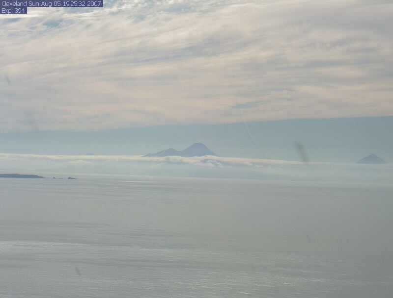
Screenshot from the interactive map on AVO March 8th. 2014
Celveland is stratovolcano with almost symmetrical shape. It is situated on Chuginadak Island of the Aleutian Islands of Alaska. It originates like all its siblings, the volcanic Aleutan Islands due to the Pacific Plate subducting under the North American Plate.
 The name comes from grover Cleveland, who was president of the USA 1894 when the Island was visited by of a team U.S. Coast and Geodetic Survey. The native Aleut name for Mount Cleveland is Chuginadak, nowadays the name for the whole island, Chuginadak refers to the Aleut fire goddess, thought to reside in the volcano. A lack of erosion shows that Mount Cleveland is likely a Holocene volcano, forming within the last 10,000 years.

http://www-tc.pbs.org/harriman/images/log/lectures/crossenvol/subduction_lg.jpg
Subduction of the Pacific Plate beneath the North American Plate creating the Aleutian trench and volcanic island arc (Credit: Alaska Volcano Observatory)
It is one of the most active volcanoes of the Aleutian arch. No permanent settlements are located on the Chuginadak Island. So no people are in immediate danger should Cleveland decide to erupt. But an ash cloud could threaten planes because a frequently used route comes close to the vicinity of the volcano and this is why Cleveland is being monitored using satellite imagery. No seismic equipment is on the island.

Image Wikimedia Commons
There used to be a webcam pointed at Cleveland. I checked it frequently but there was hardly ever anything to be seen due to bad weather or nighttime ;). The site states that the cam needs to be rehoused as of end of December 2013 which has not happened yet.
Clear day image from https://www.avo.alaska.edu/webcam/Cleveland.php ( if it works).
If the cam comes back, the address should be https://www.avo.alaska.edu/webcam/Cleveland.php
Mount Cleveland seems to be a very popular volcano (?) because if you check the term volcano on Wikipedia this ->

is the top image you will see.
Quote Wikipedia: “Mount Cleveland is an almost symmetrical andesite stratovolcano in the Islands of Four Mountains, a volcanic group in the Aleutian Arc. Like all stratovolcanoes, Mount Cleveland grew as explosive eruptions, effusive eruptions, and lahars built it layer by layer into a concave-up shape. It lies southeast of Mount Carlisle and northeast of Herbert Island. Mount Cleveland forms the western half of Chuginadak Island, a broad and uneven bell-shaped landmass, and is the highest of the four volcanic islands. The island is completely uninhabited; the nearest settlement is Nikolski on Umnak Island, about 75 km (47 mi) eastward.“

From the interactive map. Description: Aerial photograph of Cleveland’s August 2011 lava and summit crater. This lava dome was extruded sometime after July 7 when the last clear view of the summit area did not show this feature. The formation of the lava dome is consistent with thermal anomalies observed in satellite imagery since July 19, 2011. This dome is approximately 60 m in diameter in a 200m-wide crater. Photograph courtesy of Dave Withrow, National Oceanic and Atmospheric Administration.
The Alaska Volcanic Observatory gives lots of information on Cleveland. https://www.avo.alaska.edu/activity/Cleveland.php

Image : Wikimedia Commons
Links:
- Wikipedia Cleveland : http://en.wikipedia.org/wiki/Mount_Cleveland_(Alaska)
- Volcanodiscovery: http://www.volcanodiscovery.com/cleveland.html
- Geology Com : http://geology.com/volcanoes/cleveland/
- Volcano World : http://volcano.oregonstate.edu/cleveland
- GVP : http://www.volcano.si.edu/volcano.cfm?vn=311240
- Volcano Live: http://www.volcanolive.com/cleveland.html
Spica

Another ASTER image: http://en.wikipedia.org/wiki/File:Alaska%27s_Aleutian_Island_(ASTER).jpg


Thank you Spica!
Good catch, had missed that Cleveland was misbehaving
very good pics for an interesting article. I particularly like the animated gif of the ashcloud.
Revisiting the Cal Quake thing.
Much of the follow-on activity appears to be stress redistribution in the Gorda microplate but mostly in the accretionary prism.
In the accreationary prism? Hm, sounds like Lassen might have fun again somewhere in the future.
Getting weird….
Chinese media reports that a number of families have been able to ring mobile phones of their missing loved ones but no one answers.
The development raises even more questions about what has happened to flight MH370.
http://www.mirror.co.uk/news/world-news/missing-malaysia-airlines-eerie-moment-3222919#ixzz2vatcL932
So… why do the authorities not get a hold of the carrier and trace that path back to the cell tower in contact with the phones?
That is downright odd if it is true.
If they are alive it is due to them having been taken down somewhere. And it would take a serious amount of balls to piss off pretty much every country around the pacific, not to say the least the Chinese themselves.
If it is true they are probably hammering the local authority of were ever it is to do a grid search. But, anyone savvy enough to abduct an entre airplane would most likely have taken the phones and just piled them up and destroyed them. These phones would probably be phones left on the presumably abandoned airliner.
Just out of the hat, but there are 4 types I would suspect. 1 Indonesian rebels, 2 Phillipine communist guerilla, 3 Thai Guerrila (rather atypical of them) and 4 Professional Chinese Pirates going for ransom. An obvious fifth would be a Government of course, but that would lead to a nasty war if they got caught with it.
Will be interesting to know if anyone will be able to corroborate the chinese media claims.
That “obvious fifth” thing bothers me. The CIA has the nasties (and stupidity) to pull a stunt like that, but then the question comes up, Why the @#$@ would they do it? They would seriously need the help of their Nemesis, the NSA, to cough up evidence that the CIA was not involved.
I have a few friends who work in the cell industry, I’ve posed the question to them to see what they think. (asked about the technicals of tower to cell communications and whether the system would/could generate a ring signal to the caller even if the phone was out of circuit)
I am seriously doubting the US to have anything to do with it.
A plane with 300 people loaded with Heroin? Oh yeah… that would be likely, but something like this? No…
They would need a damn good reason to do it, half of the leaders of El Quesadilla on the way for a bear hunting trip in Kennebunkport would do it, but anything less, no.
Not necessarily the CIA Heroin angle, something different.
This thing just doesn’t smell right. Pretty much any aircraft decelerating from above 500 kts to zero is going to come apart. And yet there is no debris. On the news they had (probably stock) footage of an open ocean search in progress… in the South China sea. I had to laugh. I’ve been in the South China sea and there is all sorts of weird shit floating around out there. We even ran across the prow of a sailing craft just bobbing along in the open ocean. We sent a rescue swimmer over and he popped back out of the water almost as fast as he went in. The rest of the boat was missing and he didn’t like coming face to face with the Makos that were loitering around. Due to tasking, we couldn’t hang out and shoot it with the 5″. Ordinarily such stuff is dispatched as a hazard to navigation. We were allowed to riddle it with small arms fire so that it would eventually sink, but the 5″ would have been more fun.
What I find really odd is a couple of other things.
1. The Airplane failed to check in with a control tower in Malay.
2. It was tracked as it was nearing land in Vietnam, but did not contact the Vietnamese flight control.
3. Then the airplane dived rapidly in under radar coverage and disappeared.
I am not an airline pilot, but this sounds odd enough. But the facts seems to be exactly like this.
Now comes the odder parts. The 12 km oilslick does not sound like an airplane crash, sounds more like fuel dumping to lighten the airplane for a short runway. The oilslick is on the path before it disappeared from Vietnamese radar. So far odd.
Now a slightly related oddity. The Malaysians are not seeking there, they are making a huge hubbub in a different spot of the ocean that is neither where the oilslick is, nor where the plane dived.
Something does not add up bigtime. Sounds more like the plane was taken down on some “short” runway somewhere and the passengers moved for ransome, or a few more important passengers were taken and the rest was shot on site. But that is just blatant guess work.
Well, per the “news” the oil slick did not test positive for being from the aircraft. DFM and Jet-A are pretty similar, but a good lab should be able to discern the difference. We have even used a contaminated Jet-A equivalent (JP5) in our boilers. (cheaper to burn it as fuel than to carry it around for disposal)
Red herring.
If you switch your phone off (or put it in flight mode) the network gets an ‘I’m going off the air! Goodbye!’ message from the phone. So the network knows to not even bother trying to connect a call to that phone, and it goes straight to voicemail – until such time as the network gets a ‘Hi! I’m awake and on the air again!’ message from the phone when it’s switched back on.
If you don’t switch off your phone, and just move out of range of the network, there’s no ‘Goodbye!’ message from the phone, and the network retains the information for the last cell tower the phone was in contact with. If a call is placed to the phone, the network generates a ring tone while it tries to contact the phone to place the call.
All they’ve done in that story is identify those passengers who neglected to switch off their phones before takeoff…
Do not know how the Chinese phones work, but there has not been a phone working like that for a long time here in Europe. The phone pings continously the cell-tower and if the phone is off the answer will be depending on if you have voicemail or not. If you have you will go straight to voicemail, if you have not you will get “the recipient can’t accept your call at this moment”.
The way you describe sounds like the american system. I think the chinese is on a more modern 3G or 4G network working like the european system.
Ie, a dead phone would not “ring”.
Latest WTF is that the Malaysian military has radar data showing that it was last tracked near the Straits of Mallaca.
Two Iranians were the passport oddities, and that they may have been seeking to defect. If the IRGC had a mole in the cockpit that would account for the loss of transponder data, and the Indian Ocean is a pretty large place to loose an aircraft if no one was watching. As far as I know, Gonzo sttation hasn’t been used for years, so no one was there to see any thing.
There was an eruption at Cleveland last year right?
According to GVP, yes, and based on the listed dates, the episode is probably still ongoing.
2013 Dec 28
http://www.volcano.si.edu/volcano.cfm?vn=311240
Who knew that “Scots” was an acronym? Southern Culture On The Skids.
Pretty tight band. Loved the wig on the bass player. Don’t find bands like that around here which is a shame. Nothing makes a bar go bopping like it.
Well, the prancing brunette got my eye, looked a lot like a girl I used to date… 35 years ago. She was the one that I had the unfortunate Jack Daniels event with. (woke up in the wrong bed, her sister’s. I don’t think anything untoward occurred, but I was quite embarrassed. I won’t touch JD to this day because of that. I’ll stick to Jim Beam for hard core drinking.)
NOTE: I’m pretty sure that she doesn’t look like that anymore.
What I like about the band is that they remind me of the typical “live band” dives in the deep south. The ones who usually cover the more well known songs… poorly. It’s pretty rare that any of them have their own music.
OT.
Someone likes “Volcanoland”.
Nothing OT about Volcanoes. They can snap you back from memory lane in an instant. I’m just glad they didn’t have the usual media hack on there. They tend to wheel his ass out in order to lend an air of credibility to whatever they are trying to push. “Look! Look!, here is an actual scientist who agrees with our alarmist rhetoric! Be afraid, be very afraid, your all are gonna die!, we’ll have more after the commercial break” Even though said scientist is completely outside of his field.
Not mentioning the name, the regulars know who he is.
And a bit-o-sheep to get things back on track.
Argh…. Pacific plate, not Juan de Fuca!!!! Although the Okhotsk may be a remnant of the Kula plate, and parts of the Farallon might be sitting around under there…
Valid point. Though the Rivera, Cocos, Explorer, Juan de Fuca, and Gorda are the only shards that I know have a connection to the Farallon.
The Nazca plate is, too.
There are also plenty of terranes left from these plates, and pieces of slab from these are still sitting under some subduction zones.
A couple of “observations” on the 6.8 NorCal earthquake:
Based on a “typical” strike-slip event in this part of the world, an earthquake this size should have a rupture length of about 20-30miles, In addition, stress (or stress-relief) can be dispersed/redistributed over a much larger area (thanks Lurking!). However, I noticed three shocks (two inland) that preceded the main event, so stress re-disribution had yet to occur. These three events were all well East of the epicenter and minor in comparison, and are noteworthy only in their proximity time-wise to the main shock farther west.
So, I did a bit of checking on the nearest webicorders to these earlier events (not ready to say they were foreshocks) and found what appears to be signals resembling “tremor” of some kind that showed up at both Crater Lake and Mt. Shasta seismos both before and after the main shock, with both having a multi-hour period of quiescence immediately after the shock…so ambient noise such as weather can be reasonably discounted. If you look closely at the seismos, especially from Crater Lake (gotta look hard), there is a wide variety in the seismicity, with earthquake shocks clearly distinctive from the other noise. On the whole, the webicorders, (especially the one at Mt. Shasta), is somewhat reminiscent of deep tremor: and I wonder if deep tremor might possibly have been involved as a “trigger” mechanism for the main shock? In some cases, there appears to be some similarity to Bob’s “wet tremors” indicating fluid movements at depth.
I am not suggesting the “vibration” per se from tremor so far away was enough to directly trigger an earthquake this size, as these type of silent seismic events occur frequently and rarely (but someimes do) correlate to nearby earthquakes. but I do know that deep tremor itself can occur over much larger areas than a rupture zone and can last anywhere from hours to weeks..so whether or not deep tremor is/was at all involved is still kinda intriguing.
Personally, I think the three pre-vents and seismic rumblings are mere co-incidence since all occurred in a highly active seismic zone, but it’s fun to speculate none-the-less.
USGS: Volcano Hazards Program – Mount Shasta Monitoring: Monitoring
Seismogram Viewer | Pacific Northwest Seismic Network
Here is a bit from Berkley’s Seismo Blog:
http://seismo.berkeley.edu/blog/seismoblog.php/2014/03/10/the-strongest-california-earthquake-in
Good blog too worth a look.
This is why we kept our China Cabinet bolted to the wall in Port Orford I’d be more concerned if
it was farther north on the Cascadia…
Continuing the speculation, it could have been slow-slips increasing the weight of the subducting Gorda-plate that is having it’s accreation prism right under Shasta. So if that plate sliped there it would have changed the stress-dynamics where the earthquake took place.
Highly speculative though, and I think that the slow-slip would have to have taken place weeks before the event for the stress to redistribute all that way effectively.
/Warning, speculation/
interesting idea – hard to get my head around any way it might be verified/discounted
The goto-guy on the matter would be John Vidale.
I could happily refer the question to him if Craig wants to. I guess the answer might interest quite a few people in here.
By all means, if John V. can shed some light on the possibility of slow slip being possibly involved in acting as either a trigger mechanism or as a direct source of elevating stress on the hypocenter / fracture zone for this particular quake, I would very much like to see an “experts” opinion!
After all he is the world leading expert on slow-crawly quakes. 🙂
I’ll put it by him and see if he answers.
so I had a moment of of google-earth volcano serendipity last night, and thought I would share it.
So for reference, it’ll help if you view the image below.
I had known for a while that there were quite a few debris avalanches (some small, and some massive) in the central american volcanic arc, but I hadn’t really realized the degree. What I think I found, is that the entire “bulge” of land that occurs on the Guatemalan coast from roughly Tacana to Pacaya is likely a product of volcanic debris avalanches & ashfall deposits. Most of us are accustomed to land-growth from effusive volcanoes (see Hawaii), but it’s interesting to see how large-scale collapse events can actually expand the growth of a coast here.
Now, I don’t have any definitive proof that the bulge on the coast here is entirely related to volcanic activity, but if you look at the image, there is another smaller area on the right highlighted, which shows a small peninsula jutting out into the ocean somewhat abruptly at the base of Izalco / Santa Ana. That piece of land jutting out is from a well-studied flank collapse event that occured from Santa Ana volcano in the late pleistocene.
Now, imagine a bunch of volcanoes slowly experiencing similar collapse events, and eventually, instead of a narrow peninsula, you get a broad expansion of the coastal plain, most of which is the product of volcanoes collapsing over, and experiencing massive landslides all the way into the sea. Further proof comes simply from the fact that most of these volcanoes have experienced known caldera collapse as well as debris avalanche events in their lifetimes, most of which were likely quite massive – which resulted in the expansion of the plain. This is also somewhat interesting since it directly correlates with the region in which the volcanoes are most active in central america.
Most of those are from Amatitlan Caldera that has suffered 11 VEI-7+ eruptions in the last 270 000 years. How about that as a landscape artist. Guess where there is a capital city now?
The rest is from small stratos like Fuego and Pacaya and the massive Atitlan Caldera.
Yeah, that area is pretty darn explosive. Can we get a request for a post on Amatitlan? 11 VEI-7 eruptions is pretty nuts, and that output may make it one if not the single-most prolific magmatic are of the world in the last 270,000 years. The only area of the world I can think that may possibly have had more magmatic output than Amatitlan are perhaps Toba (all in one shot), Taupo, and perhaps Aso in Japan. With that said, that’s some pretty big company to be able to keep up with.
There are a few, but not many.places that active.
I am planning a piece, but it will take a bit of time to complete.
This video has been shot with “superstars” Boris Behnke and Marc Szeglat on Etna and was shown in Servus TV. Courtesy of Les Djles (Facebook) who allowed me posting it over here. It is in German but it is fascinating to see Etna’s features from so close, and Boris’ explanations.
Fantastic! Thank you very much for sharing!
thank you Renato !
I just finished watching the video and it is a must see. Boris seems to own the place (it is true in a way) and we see some serious degassing on the crater rim. Also the video shows some real nice lava bombs (around 8-9 mn) worth the look. I’m wondering at the possibility to use a small drone to get into the crater and try to get pictures. Ich hab nichts alles verstanden aber es ist gut für mein Deutsch !
It’s times like this I wish my German was more extensive then “ein bier bitte”!
quick highlights, walking through pyroclasts very friable break even under rainfall releasing nutrients, the spot was all green forest but now has new shoots everywhere, the big bomb that is picked up and put in the car is the biggest boris has seen at that 5km range – so is being taken for measurements, the massive rock he stands behind later and makes an explodey sound is a fragment of the cap that had formed due to (before?) lava fountaining, the house had been shut with no response to knocking so the police broke the door in and found an old married couple fast asleep with the lava only 100m away, 10mins later they were out and the house was engulfed. I’m sure there was more but those were the bits that stuck in my head after 1 viewing. 🙂
Thanks Edward, I got a lot from the gestures and recognised few key words such as Voragine, but had no idea of the story of the old couple!
Thank you Edward for the preliminary summary 😉
Here’s a bit more detail: The initial scenes are in the INGV-Osservatorio and especially in our Operations Room, where we talk about recent budget cuts to the institute, you also see my colleagues Alessandro Bonforte (GPS expert) and Filippo Murè (technician, specialized in gas measurements). We hear the acoustic alarm triggered by a small earthquake (note how different the sound is to the fake sound displayed in the recent Discovery Channel bit entitled “Volcano Time Bomb”). Then comes the bit on the road where I talk about how Marc Szeglat and I met, a long time ago, as geology students at the University of Bochum in Germany.
Then I give a statement about how important it is, even with all modern instrumental monitoring, to do research and observations out in the field. We visit the beautiful birch tree forest on Etna’s northeast flank, which has suffered from heavy pyroclastic fallout during the paroxysms in the spring of 2013, and look at the impressive deposit, which contains a number of very large fragments (up to half a meter across) at 5 km distance from the source, the New Southeast Crater. Holding one of these large pieces, I say “if such a chunk falls on your face, that’s the end., and then take it to the car to measure its size.
The next scene is near the ruin of a house that was destroyed by the very dramatic, destructive and potentially devastating eruption of 1981 on Etna’s northwestern flank near the town of Randazzo. There I tell the story of an elderly couple that were deeply asleep in a country house in the path of the 1981 lava flow, and who could be saved in the very last moment before the unusually fast-moving lava flow overwhelmed their home. The next scene is at the southern base of the New Southeast Crater, in an area littered by very large bombs during the paroxysms in the spring of 2013. “These are the largest bombs I have seen since a gigantic paroxysm with a 2000 m tall lava fountain on 4 September 1999.”
We then climb to the rim of the Voragine, one of the large summit craters of Etna, and you can see a lot of snow there – the filming was done in June 2013. I talk about feeling unconfortable because there might be phreatic explosions, which can occur suddenly, without any precursors, and about the impressive gas emissions (1 million tons of water vapor, 50,000-100,000 tons of carbon dioxide and several thousand tons of sulfur dioxide are emitted from Etna every day), before the clouds briefly open up to reveal the inner pit of the Voragine. Finally we do a fake “goodbye” at the tourist area of the Rifugio Sapienza, as weather conditions (as they usually do during the day) rapidly deteriorate.
thanks Boris it looks amazing – I particularly liked the birch forest – it seems so alien yet totally familiar at the same time.
What a terrific job you have Boris, and what a pleasure to see how much fun you get from it. The video is beautiful and we really get a totally different perspective from a a volcano that we watch (at least myself) in a daily basis!
Many thanks to you and Marc! – I am proud of my virtual friends!
I read that there will be a number 2 video. Can’t wait to see it!
🙂
sehr cool 🙂 as they say
Wow! That is some close-up shot.
Thanks, that answers my above question !
And this is probably the best use of a drone that I can think of. They used a quad copter drone to do the shoot. Thing runs about $600 to $900 USD and has a GoPro attached to it. I watched a related video on the DJI Phantom and was blown away by the sophistication of the avionics package that is built into the thing. It makes it quite easy to use and fly, with most of the stability adjustments being built into the control package. Essentially all you have to do is steer it to where you want. In the demo video, the guy driving it accidentally hit a structural member of the wharehouse/studio apartment he lives in and the thing fell quite abruptly, but righted itself and went back to stable flight within about 30 feet of drop.
In a recent news show on local TV, they spotlighted a
crowncrowd shot at the Mardi Gras shindig down at another community that had been shot by a viewer… it was also done with a GoPro and a quad copter. Per the other video, you get about 15 minutes of flight time on one battery pack.I can see where I could get in a lot of trouble with a gizmo like this. Some agencies don’t like to be filmed.
GET THIS, it even has the ability to travel back to its home position (launch position) autonomously if it looses communication with the controller!
A teenager in France has filmed his hometown (Nancy, in the east), posted it on YT and got a huge audience in a few days. The video is really nice to watch, you see the cathedral, the main square (a unesco classified classical architecture masterpiece) and so on. Could serve has a promotional film for the tourist board easily. Unfortunately for him he also got attention from the authorities who are going to sue him because flying a drone is forbidden in a public space. These little buggers will cause a lot of problems of this type in the very near future.
However in the field of volcanology if I was a professionnal I would buy one immediately. Think only of the possibilities if you rig that up with some probes or analysers (especially if you can get the signal to be transmitted…..)
Here is the Nancy video. Amateurs of renaissance and classical architecture should have a peek.
now THAT is pretty awesome. Hopefully we’ll soon fly such a thingie over Etna … only problem is wind, and there’s almost always STRONG wind on Etna 😉
Hi Boris
We are eager to see the results ! Do you think that if you launch the device from the rim of the crater (like when you are with your german colleague on the dailymotion video) it could be OK ? I wonder at the type of probes one can install on this type of drones. I was reflecting in particular on gas sampling (a sampling vial, a small air pump, a check valve….) or how to adapt your present gas sampling techniques to this new type of equipment.
Well for the present video it really nearly succedeed in getting a fresh lava sample…. 😀
Another problem may be angry birds 😉
http://volcansvanuatueruptionsgb.blogspot.fr/2014/03/11032014-etna-colima-fuego-galeras.html
Had news about Gunung Slamet and because i have never heard of this volcano in central Java ( as i now know 😉 ) i started googling..
http://volcansvanuatueruptionsgb.blogspot.fr/2014/03/11032014-etna-colima-fuego-galeras.html
Seems to be published today, not sure about the source.
http://www.volcanodiscovery.com/slamet/news.html
Cleveland appears to be one to watch.
Of-topic but fascinating; NZ scientists have taken Taupo pyroclastic deposits, reheated them and pressurised them with gas, and are using them to simulate PFs…
http://www.stuff.co.nz/manawatu-standard/news/9818045/Scientists-construct-eruption-machine
“We were expecting flows of 9m per second but we are actually getting more like 25m per second which is a big difference.”
That means that they probably have something in their simulation that equates to the real deal. One of the greatest oddities of a pyroclastic flow is why they are so lethally fast.
Cool! My hometown!
Good nite, fellows. http://wattsupwiththat.com/2014/03/10/volcano-activity-temperature-and-response-times/
Cheers
Problem with that analysis is that it uses only the CET, and a single point data list only tells what happened in England for that year. Why is that wrong?
Well, let us say that you had used data for Florida, then you would have come to the conclusion that the Kamchatkan eruptions of 2013 affected the global temperature significantly. Which it did not of course.
Always beware of studies based on one single spot of measurment. Local phenomena will always be the largest looming factor. In effect, it is useless.
Willis is quite aware of the vagaries of under-sampled data. In lieu of more points he has to make do with the CET.
BTW, in my book, Willis is bad ass when it comes to data. He scraped together an extensive ARGO data set from the buoy data using scripting and the individual source files that yielded a really nice exposition/discussion about sea temps and the “missing heat” issue that has plagued some of the Goreian acolytes. (Kevin Trenberth had characterized GW science’s inability to account for the heat that was claimed to be in the system but wasn’t as being a “travesty”)
In regards of making extrapolations of temperature sets from just one datasource I have a rather hardcore opinion. One can have a good theory, good methodology, but one will still just produce unverifiable mush since one is only working on the local plane.
Let me expand on that. In north america there has been the harsest winter in some time. Here it has been a record warm and record short winter. I could say it has been like that due to the lack of a significant eruption, and someone in north america could blame the Kamchatkan volcanoes for the cold. Obviously neither of us would be right, but the point is instead that neither of us can judge global averages from our local vantage points.
There is a point in science where one just has to give up. Doing extrapolations backwards in time just do not yield good data. We will just have to wait for N=100 VEI6es and N=10 VEI7s before we can do anything. Anything else is just idle speculation.
RE: 6.8 NorCal Quake:
As mentioned earlier, this part of the Mendocino Triple-Junction has had a LOT of serious activity in a relatively short period of time (~90yrs)….with very little activity further away. Below is an excerpt from the USGS with a recent seismicity review: (they also are confirming this new event had an oblique strike-slip focal mechanism)
“Several large earthquakes have occurred in this region since 1900 within 100 km of the March 2014 event, including events of M7.2 in 1922, M7.1 in 1923, M7.3 in 1980, M7.0 in 1994, M7.2 in 2005, as well as several events near the coast or inland of California, including the 1992 M7.2 Petrolia earthquake with its M6.6 and M6.4 aftershocks. Most recently, an earthquake of M6.5 in January 2010 with a similar faulting mechanism to the March 2014 event occurred”.
This is a lot of energy being released, and realistically speaking, how could this amount of crustal movement NOT be indicating a huge amount of accumulated/accumulating strain on “unrelieved” portions north of MTJ?
Well, since it’s officially designated oblique strike-slip, here is the Max and average displacement across the fault face for an M 6.8 with a strike-slip mechanism.
Max 0.94 meters
Ave 0.63 meters.
Subsurface rupture length 44.26 km, Max surface rupture length 30.34 km. Estimated area of rupture face 414.09 km² (simple ellipse) with a down dip rupture width of 11.91 km.
Figures in bold are derived from the Wells-Coppersmith formulas and are valid at the 95% confidence level.
With a listed depth of 16.6 km, it is unlikely that the fault break made it directly to the surface, (greater than half of the down-dip rupture width) though sediment deformation could show up on the seafloor.
New Empirical Relationships among Magnitude, Rupture Length, Rupture Width, Rupture Area, and Surface Displacement Wells-Coppersmith (1994)
a good article on another Alaskan volcano
http://www.nationaljournal.com/pictures-video/america-s-least-visited-national-park-is-a-sublime-pit-of-hades-20140311
And my article on Aniakchak.
https://volcanocafe.wordpress.com/2013/10/28/the-great-american-volcano-aniakchak/
it is 3 years now since this fateful day, a reminder how insignificant humans are after all
I get chills every time I see that-it is almost exactly like Coos Bay/North Bend Oregon.
OT interviewed with a single engine Airtanker Outfit local and new..
Airtractor 802’s :http://www.youtube.com/watch?v=EgATvV0Z7b8
cool
I vaguely remember that we have a few Hekla fans in this group here … and while we’re waiting for Hekla to do something, here’s one of the finest reads on the subject that exist, in downloadable PDF format: Thorarinsson’s famous “The eruptions of Hekla in historical times” of 1967. That should make for a good read for all of you who don’t own a paper copy of it !!!
http://www.lsndocuments.info/Documents/wp0062.pdf
Thank you!!!
Boris, Thank you for the link. Seems the link is down at the moment?
Let’s try this? In fact I found it on a Google search results page.
http://www.google.it/url?sa=t&rct=j&q=&esrc=s&source=web&cd=6&cad=rja&uact=8&ved=0CFQQFjAF&url=http%3A%2F%2Fwww.lsndocuments.info%2FDocuments%2Fwp0062.pdf&ei=dBggU6bJH7Tw0gWKkoD4Cw&usg=AFQjCNEJYm_M7qhu09o5dwo6t7fp9mGYvA&sig2=bAnZdC3BK7Kxeov8xXdOsw&bvm=bv.62788935,d.d2k
Joy and happiness and bedtime reading 🙂
Thank You! My gurgle attempt at it failed horribly.
Interesting tidbit in that document;
“We know from the study of later eruptions
that there is a determinable relationship between the SiO2 content of the initial eruption products and the length of the period of quiescence preceding it. In the light of this, it can hardly be thought possible that Hekla should have emitted pumice with an SiO2 content of nearly 67% – the figure for the ~ 1104 layer – unless the preceding quiescent period had been of some long duration: certainly much longer than the periods of quiescence between the following eruptions.”
Click to access wp0062.pdf
So, 1104 likely marked a state change in Hekla’s behavior.
Yes it did.
It was depending on how you look at it either the last eruption of Phase I, or the first eruption of Phase II at Hekla. Same goes for 1947 that was either the last of Phase II or the first of Phase III.
Danke Sehr für Ihre Bemühung !
“I vaguely remember” … Yup, we are waiting for her. Extremely patient by todays standards, as everthing is instant news, even the tiniest of quakes.
OT
Yet news fail finding an jumbo size airliner. Anyone checked Malaya area for “very shallow” quake sometime between 17:21 UTC and 18:00 UTC Friday 7th March 2014. Unpowered glide from 35.000 ft takes no more than 20 to 30 min. Less in vertical attitude.
4,259,439,336.24 Joules of kinetic energy should be about Mag 3.2 on impact.
Assumption – 134,800 kg mass and 251.389 m/s impact velocity.
IMO → The aircraft didn’t crash or didn’t crash along the declared flight path. I think it was an IRGC action.
Thumping into the ocean would take a way a potential of energy. So a M2 if it hit water.
It would be interesting if someone had a sonobouy array deployed around that time frame. Was anyone out prosecuting a sub in the area? It would have shown up as an artifact if they were. (And probably would have scared the shit out of the sonar operator)
If it went down it would have been a Vietnamese sonar operator. And I am not sure about what they might have deployed out there.
Not sure. “News” reporting says that the Malaysian military has radar data pointing to the northern reaches of the straights of Mallaca. With that and the revelation that two of the passengers were allegedly Iranian asylum seekers is what leads me to think it might have been an IRGC mole at the controls of the aircraft.
Yeah, they used to be bumbling clusterf$@#$’s, but that doesn’t mean that they haven’t gotten better.
One of the Iranians apparantly was going to Sweden were he had relatives. Ie, your garden variety refugee that we get every day. So, at least one of those passports are accounted for. Our security police took one look at the case and droped it when they had checked the emails and text messages between him and the relatives.
Normally they “loose” the fake passport en route and go straight to the boarder guards and request asylum. The other one was most likely going to do the same thing.
So, if stolen. Who needs an Boeing 777 and what for… ?
Another 9-11 or (same purpose) nuke delivery platform ?
But somehing I read, it got ACRS system
(independent from ADS-B as Flightradar24.com sees)
The airline go access to that. What info has that ?
(or has it any we do not already know ?)
Yep, I checked FR24 for the MH370 climb and enroute cruise at FL350.
It was crusing happily… when it dis-appeared.
When it disappeared it had neglected to make two tower-calls.
I am thinking more about whom they’ve got from the airplane. I am sure that pretty much every intelligence outfit on the planet is going through the passenger lists like flies on a dungheap by now. I am still half expecting either a ransom note for each passenger, or that a whopping big one have been issued for one or two passengers and that the rest are killed by now. (just idle speculation, I have no information other than publicly given on this)
Yes, same here. I have no info either, other than idle speculation. *Plot thickens as they say
By the way, welcome over to the new post 😉
Thank you!
That should keep the crowd happy 🙂
Seismic swarm and yellow alert for Copahue (Chile-Argentina)
http://www.losandes.com.ar/notas/2014/3/11/alerta-amarilla-sismos-reactivacion-volcan-copahue-772484.asp
And another (small) quake near Hekla:
Wednesday
12.03.2014 11:09:27 64.009 -19.985 8.1 km 0.6 99.0 13.0 km SW of Búrfellsstöð
For whatever it’s worth – I came across an old excel file I had found a while back but couldn’t locate again until now. For those who like researching calderas, this file is golden. It’s missing a few calderas, but it’s pretty comprehensive and includes a lot of information not found in the GVP.
Link : http://www.geog.cam.ac.uk/research/projects/lveed/
This is the University of Cambridge dept. of Geography database of Calderas. It’s not 100% perfect, but it’s the best database I can find regarding huge eruptions and calderas.
The most astonishing thing I learned from looking at this spreadsheet is just how astonishing Kamchatka is from a volcanic perspective. I had known Kamchatka had a lot of large caldera systems, but I hadn’t realized that many of the caldera systems I had recognized were actually nested smaller caldera that are part of a much larger caldera complex. And when I say nested calderas, I’m implying that the nested calderas are larger than huge volcanoes like Atitlan, Aira, etc etc. Most of this information is not listed in the GVP project, so it wasn’t something I had realized previously.
All in all – there are 6 volcanic calderas in Kamchatka that are legitimate supervolcanoes if we’re to correlate size with eruptions. These all approach or exceed the size of Taupo, Tondano, etc. It’s too bad there isn’t nearly as much research done here as there is in the United States, New Zealand, Iceland, or even South America.
-Pauchetka Caldera is an approximately 40km caldera, which includes the Kurile Lake caldera (VEI-7 about 6000 years ago) as a nested caldera.
-Ksudach is actually a volcanic caldera that is part of a much larger 35km caldera that’s largely hidden. I knew Ksudach was explosive, but had always thought that the exposed caldera was all it had done, and wasn’t a nested caldera of a much larger system.
-Uzon-Geizernaya and Bolshoi Semiachik calderas both are huge (15-20km) nested calderas that are part of a massive 48×40 kilometer caldera, which is on par with the size of Yellowstone.
-Maly Semiachik is actually a series of nested calderas. The large parent caldera is approximately 50km in size, which once again, is in the Yellowstone size limit of “this thing is huge”.
-Ichinsky volcano is listed as having a 44x40km caldera further inland in Kamchatka.
-Bolshe-Bannaya caldera is a 30km caldera in central kamchatka (found in GVP, not this spreadsheet).
Wow, good find!
So I guess as Carl would say, some volcanoes need better PR Agents. I would argue that Kamchatka as a whole needs a better PR agent as it’s probably the most prolific area in the world for volcanic eruptions. Having 6 volcanoes on that peninsula that make Campi Flegrei look like a blip on the radar is pretty astonishing.
You stole my favourite sentence
Kamchatka is probably looking today like Alaska will look in a few hundred thousand years. I am still believing that the most likely area for new caldera formations is up there instead of at a known place like Kamchatka. All the signs are after all there.
That is my main reason to really want to cry over the resent budget cuts for Alaskan Volcano Observatory. It is really risky to do those cuts, even though the volcanoes are remote.
Apologies for getting political here but it looks like AVO is short about $2.5 million due to a grant from the FAA (civil aviation agency in the US) going away a year or two ago. Local political cynics think this is the current administration getting even with a state that does not support them. They have played this game with natural disaster designations in other states over the last 6 years and is known as the “Chicago Way.” AVO lost monitoring on 4 volcanoes including Aniakchak and FourPeaked which was not monitored prior to its VEI 2 Sept 2006 eruption. Cheers –
https://www.avo.alaska.edu/news.php?id=841
Political on volcanoes is always okay.
I hope that they will get the funding back up before it is too late.
Aniakchack will most likely not produce anything significant in the next couple of thousand years, but Fourpeaked is definitely on my shortlist of a volcano capable of going caldera.
Well, they have to do more important things with that funding… like phones, “clinics” and twerking classes for high schools.
Why Fourpeaked?
One of these days I will Fourpeak for the Edification of the Crowd in here. 🙂
Fourpeaked seems like a strange volcano to pick. It’s not particularly huge, has had very little activity in the last 10,000 years (not that that precludes a potential large eruption), and I can’t find any information on it online beyond a phreatic eruption in 2006.
Care to explain any reasoning Carl?
I will get there sooner or later.
I have been intending to write a piece about it for quite some time, so expect one sooner or later 😉
Interesting. I would have picked Redoubt rather than Fourpeaked. Cheers –
No ‘doubt at Redoubt either 😉
Jamie from Iceland got all social networks locked off by his company and so sent email:
” On IMO‘s GPS page there are some new data points availble.
http://gps.vedur.is/mapGPS.php
If you look at the meters around Hekla you can see there are some trends starting to appear. The „NORS“ site is reading a steady south-east direction And the Hekla site had a nice jump North.
IMO has their hands full diserning the quakes from the storm yesterday, but I‘m sure we will see some „revised“ quakes.”
Thank you Jamie!
Hope that Jamie will get back online soon 🙂
I doubt that IMO will ever get quakes out of the Hekla area for that period, the noise level was insane during the storm. Only M1.5 and larger would be able to stand out significantly enough to be ID.
We’re a social network? Ick.
New 5.1 jolt off the coast of Oregon. This quake occurred in another seismically active area near the WSW edge of the Juan de Fuca, well aways from the earlier 6.8 near the southern edge. Pity the USGS has not released a moment tensor solution as yet, but the depth (10km/6.2 miles) would suggest a strike-slip component was involved. Spatially speaking, these two moderate quakes are quite far apart and near different fault lines, and therefore most likely totally un-related (unless there is another common-mode trigger mechanism involved like slow slip / deep tremor). Hopefully Dr. Vidale can shed some insight on our musings?
Event Time
2014-03-12 00:31:44 UTC
2014-03-11 15:31:44 UTC-09:00 at epicenter
2014-03-11 17:31:44 UTC-07:00 system time
Location
44.323°N 129.149°W depth=10.0km (6.2mi)
To clarify, the 6.8 of a couple days ago occurred within the Gorda micro-plate which is the southern section of the Gorda/Juan de Fuca/Explorer micro-plate complex. Googling the proximity to today’s 5.1 up on the Juan de Fuca, these two events were over ~320 miles apart…way too far to be “directly” interconnected.
Max displacement → 1.67 cm
Average displacement → 1.86 cm
For a Mag 5.1 in a strike-slip fault. (using Wells-Coppersmith)
New article is up!
https://volcanocafe.wordpress.com/2014/03/12/whats-up-with-iceland-hekla-edition/