In light of the extremely unique and interesting events going on at Vatnajökull, it’s interesting to ponder how different they can be from one another. I had originally intended that this post would be an ordered ranking of the strangest volcanoes in the world, but you really can’t form proper comparisons between one type of weirdness and another.
The other problem I had is a lack of information. Part of the issue is that a lot of money goes into researching a limited amount of volcanoes every year. Due to requiring grants to fund research, researchers typically focus more of their attention on volcanoes that are currently erupting, close to large population centers, and in countries that can afford to subsidize such research. So while there are likely many more oddballs out there, they may not be known or studied enough to make it into this post.
In this post – I’ve separated out a grouping of 8 volcanoes in no particular order, and listed what it is that makes them particularly strange. Most of these volcanoes are somewhat well known, and a few have had posts on here already. Hopefully, this post will raise as many questions as it provides answers 🙂 .
Clear Lake Volcanic Field
The Clear Lake Volcanic field just may be the strangest volcano out of all the volcanoes on this list. One of the first things people learn when studying volcanology is that volcanoes can form in three primary ways:
- Subduction
- Hot Spot Volcanism
- Rifting
What makes Clear Lake odd?
The foremost oddity of clear lake is that its formation and existence is still a bit of a mystery. It does not sit on a subduction zone, it does not sit on a rift zone, and it does not sit on a hot spot. So how does Clear Lake volcanic field exist? Clear lake actually sits at the end of the San Andreas fault, and its formation is likely a result of an extremely complex area of tectonic activity. According to the USGS, after subduction stopped in California over 2 million years ago, a slab gap opened up in this area (which is also a tectonic triple junction) resulting in upwelling magma. While subduction has stopped, the complex tectonic setting caused localized spreading, which likely feeds the ongoing volcanism in the area.
Clear Lake doesn’t have any known eruptive pattern. If anything, the pattern for Clear Lake’s activity is that there is no pattern. Eruptions were fairly active from 60,000 years ago until 10,000 years ago, and since then they have all but stopped. While there have been no large eruptions at Clear Lake, it seems to be bimodal with basaltic eruptions as well as rhyolitic lava flows and dacitic eruptions.
What Makes Clear Lake extra odd?
The final kicker that makes Clear Lake interesting and weird? It’s HUGE. Most people living in San Francisco wouldn’t have a clue that such a massive volcano sits relatively close to them. How large is Clear Lake? Clear Lake’s magma chamber is estimated to be around 1400 cubic kilometers, that’s enormous by any standard . The USGS page even suggests that Clear Lake is potentially in a pre-caldera evolutionary stage, making it potentially similar to Long Valley, its neighbor to the east. Clear Lake doesn’t seem likely to erupt at all during our life time, but its huge magma chamber does provide one of the most productive geothermal energy plants in the entire world. So all in all, just about everything with Clear Lake is strange.
Emi Koussi (and company)

If you want to find a volcano truly in the middle of nowhere, you’ll either have to go to somewhere extremely remote and cold, or conversely, somewhere extremely hot and dry. For the hot and dry category, there are far less candidates, and Emi Koussi fits the bill as one of the biggest oddballs out there.
What Makes it odd?
Emi Koussi was the single volcano chosen to replicate the conditions on Mars – what else needs to be said? Emi Koussi sits almost directly in the center of the Sahara Desert in the nation of Chad. Like other volcanoes on this list, it’s not a rift volcano, and it’s certainly not a subduction volcano. This makes the most likely culprit of its existence a hot spot, although there is no noticeable hot spot track, indicating that its either a newer hot spot, or a localized hot spot that is fixed to the plate.
Emi Koussi is not a small volcanic system. It’s a pyroclastic shield volcano with two nested 12×15 km calderas (2) indicating that its had a few very explosive and large eruptions. It also sits on the middle of an elongated fault line, where numerous small eruptive centers can be seen up to 75 km away from the Caldera. While Emi Koussi is the most well known volcano, there are actually numerous pyroclastic shield volcanoes (Emi Koussi, Tarso Toon, Tarso Voon, Tarso Yega, and Toussidé) in the area from where it originates known as the Tibesti mountains. The Tibesti mountains themselves are almost entirely volcanic in nature, having formed from numerous large lava plateaus along with sandstone and other volcanic sequences.
What makes Emi Koussi extra odd?
While not many people debate the fact that these volcanoes are the result of a hot spot, one strange (or impressive) fact is that this is a rare hot spot volcano that sits beneath the middle of a craton. Cratons are extremely thick, extremely strong pieces of continental rock, that typically serve as the anchors from which other land mass is built off. In this instance, the lithosphere is estimated at 130 km thick (according to “Volcanoes of the Tibesti massif (Chad, northern Africa)”), making it incredibly unique that a volcano punched through the middle of it. For reference of how impressive this is, many people speculate that Yellowstone will completely die once it migrates beneath the North American craton. This leaves some questions about mantle plumes in general and their potential causes.
Hekla
Hekla is perhaps the most popular volcano over here at Volcano Cafe. There may be some bias since there is a lot of research available on Hekla, or because it’s Carl’s personal favorite. With that said, Hekla deserves all the attention she gets, partially due to the eruption frequency seen, and partially due to the oddities that come from Hekla.
What Makes it odd?
Since we’ve covered Hekla in detail many times, I’m not going to go into a high level detail about it. For those interested, read the links below for more details about Hekla.
https://volcanocafe.wordpress.com/2013/04/29/countdown-to-hekla/
https://volcanocafe.wordpress.com/2014/03/12/whats-up-with-iceland-hekla-edition/
https://volcanocafe.wordpress.com/2014/03/26/hekla-and-the-global-positioning-system/
In short, Hekla is an extremely quirky stratovolcano. It behaves both as a rifting shield volcano would, but also has a lot of elements that you see from stratovolcanos such as evolved magma, a composite edifice, and explosive eruptions.
What makes Hekla extra odd?
The strangest part of Hekla is how it doesn’t show the typical signs of eruption you would see at other volcanoes. Hekla is nearly aseismic, so any earthquake that DOES happen in the Hekla area is a big deal. Hekla also shows very little to no inflation prior to a major eruption, which is extremely uncommon. Both of these characteristics fit more in line with spreading centers such as you would see from an eruption in Iceland’s dead zone (similar to Laki), except Hekla eruptions start out with explosive evolved magma similar to stratovolcanos. Needless to say, the tectonic setting is extremely complex, and the sudden onset of eruptions from Hekla with little warning make Hekla an extremely interesting volcano to pay attention to.
Ol Doinyo Lengai
Ol Doinyo Lengai is a symmetrical stratovolcano located in the middle of the African rift valley. Lengai erupts relatively frequently, although most of its eruptions are rather benign.
What Makes Lengai Strange?
Ol Doinyo Lengai is well documented as an extremely unique volcano. Among all volcanoes in the world, Lengai is the only volcano that has been known to erupt live natrocarbonatite magma, which is an extremely cold, extremely rare magma. Standard magma is full of silicate, but carbonatite magma is instead comprised primarily of rare sodium, potassium carbonite, and other uncommon minerals.
What makes Lengai Extra Strange?
Lengai sits on the edge of the Tanzanian Craton, which many speculate is the reason for the unique magma composition. As the magma plume from the African rift wells up from deep within the earth, it’s been proposed that the plume melts and mixes with minerals and material sitting on the side and the bottom of the Tanzanian craton, which is why we get such a unique mineral profile.
While magma and ash is typically conducive towards providing fertile soil to grow crops, Carbonatite magma makes standard ash seem like poison. Carbonatite magma provides some of the most fertile soil in the world, which plays a large role in the ecosystem and the incredible biodiversity in the Serengeti. While carbonatite magma is very fertile, it also weathers and solidifies into a cement like material, which blocks tree roots from growing deep underground, thus influencing the vast grassland in the region. This area may even have played a large role in the evolution of mankind.
Mount Cameroon
Mount Cameroon is an ancient volcano located on the coast of Cameroon on a corner where the land forms a 90 degree angle. It is a well known shield volcano that has erupted frequently in historical time.
What Makes Mount Cameroon strange?
Before reading anything here, I would highly encourage people to read Carl’s independent post on Mount Cameroon here.
Mount Cameroon is an ancient volcano. And by ancient, it may possibly be the oldest still-active volcano in the world, with volcanic activity in the Cameroon Line (the fault area which the volcanoes in Cameroon lie) originating over 30 million years ago. Furthermore, the area features one of the world’s largest magma reservoirs that has ever been mapped.
What Makes Mount Cameroon Extra Strange?
The fact that Mount Cameroon is still going strong after the area has seen millions of years of eruptions is incredible. Most feel that the area is part of a rift zone that originated during the breakup of the African and south american continents. While this potentially explains some of the volcanism, considering the rift only seems to be marginally active, it brings up the question of how it has supported over 30 million years worth of volcanism.
Yellowstone
So when I started writing this post, I really didn’t want to include Yellowstone. It was my hope to provide some information about the lesser-known, yet still odd volcanoes in the world. But if I’m going to be unbiased, it’s important to recognize just how strange Yellowstone really is.
What makes Yellowstone Strange?
Beyond the obvious “it’s big” argument, there is really quite a lot that makes Yellowstone a unique flower.
- There are no other volcanoes in the world that share even a remotely similar hydrothermal system. Geysers exist elsewhere, but very few of the other major caldera systems around the world show similar levels of geysers, hot springs, and thermal features that are so well known at Yellowstone. Why is it that Yellowstone’s thermal features are so much more prominent than other volcanoes?
- Yellowstone is currently the only massive caldera system in the world that was formed largely due to hotspot volcanism. Most other massive caldera systems (ie: supervolcanos) sit within active subduction zones (Toba, Taupo, the Altiplano Calderas, etc).
- The hotspot track doesn’t accurately reflect plate motion as it moves on a curve instead of a linear motion. While this is likely the result of the hotspot following the track of least resistance and moving towards faults, it’s still odd and not entirely understood.
- No other volcano can scare doomers by showing a video of Bison strolling down a roadway (okay, I kid :D)
What makes Yellowstone really strange?
Yellowstone has quite a few other peculiarities, but one of the biggest questions people wonder are why it switched from flood basalt eruptions to extremely explosive caldera forming eruptions. This is of course assuming that Yellowstone was the culprit for the Columbia River flood basalt eruptions (which may be entirely separate, or only slightly related). It can be assumed that the crust Yellowstone had to punch through changed when it migrated from west to east, resulting in a change in eruptive pattern, but even then, it’s just not that clear. Also, there are other questions relating to the Columbia river basalts: were the two even related? Another interesting scenario is that there is a bit of a chicken vs. egg scenario – did the Columbia River basalts create the Yellowstone hot spot? Or on the other hand, did the Yellowstone hot spot create the extensive Columbia River basalt group? Overall, there are countless unique oddities to Yellowstone, and while it definitely gets too much media hype, it’s definitely an incredibly unique geological area in the world.
Masaya Volcano

Masaya Volcano is a large pyroclastic shield volcano that is located close to the major city of Managua in Nicaragua. Masaya lies within a nested caldera complex (6 x 11km) and a highly complex tectonic setting. Many people consider the Apoyo caldera (which is right next to Masaya) to be a part of the same volcanic complex, with both Apoyo and Masaya being related to the larger 30,000 year old Las Sierras caldera.
What Makes Masaya Strange?
Masaya is a good example of how categorizing a volcano as a “shield volcano” or “stratovolcano” isn’t really a good way to describe a volcano’s activity patterns. As a volcano, Masaya has done pretty much everything a volcano can do. If you doubt this, look at this list for the variety of volcanic activity that Masaya has participated in.
- Hawaiian style Lava flows
- Strombolian Eruptions
- Phreatic Eruptions
- Plinian Eruptions
- Caldera forming Eruptions
- Nested Caldera eruptions
- Resurgent Doming
- Fissure Eruptions
- Pyroclastic Surges
Masaya’s size and activity is no doubt influenced greatly by both subduction and tectonic forces that have created graben structures in the region around Managua. Graben structures and crustal thinning in subduction zone areas have resulted in some really really massive volcanoes such as Taupo, Toba, Chacana, Aira, Taal, and quite a few others.
More than just the setting, Masaya’s lava itself is incredibly unique. The majority of eruptions at Masaya involve basaltic magma that almost resembles Hawaiian lava instead of traditional arc-based magma. The unique part of Masaya’s magma composition is that it features the highest amount of 10Be/9Be (Radioactive Isotopes of Berylium) in the entire world. Being that I’m not a petrologist or geochemist, I’m not sure how significant this is, but it seemed to puzzle quite a lot of researchers in the papers I read.
What Makes Masaya Really Strange?
When people hear of basaltic eruptions, they envision Hawaii, or perhaps Icelandic volcanoes. They may even think of the paroxysms that are common at Etna. If you were to be told that a large shield volcano is going to erupt a big mafic eruption, you probably would envision a large fissure-style eruption that goes on for a long time. But that’s not always how Masaya operates. Masaya has had multiple enormous, explosive eruptions that occur with primarily basaltic magma. The last of these large eruptions occurred approximately 2500 years ago, and registered as a VEI-6, being nearly the same size as Pinatubo’s 1991 eruption in the Philippines. This presents an interesting caveat to some volcanic theories that evolved magma is an absolute requirement to form a large eruption.
While plinian basaltic eruptions are extremely rare, they have occurred at other areas in the world, with the best example being the VEI-5 eruption that occurred from Tarawera (New Zealand) in the late 1800’s.
Tenerife (Teide)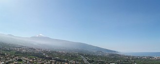

Tenirife is a very well known stratovolcano in the Canary islands. Tenerife is a member of the decade volcano program, which indicates a high level of danger it could represent to the large population that lives in a close proximity to the summit. Despite the danger Tenerife potentially represents, no major eruptions have occurred in recent times, which helps to make it a popular tourist attraction due to its natural beauty and mystique.
What makes Teide Strange?
The Canary Islands themselves are an interesting spot of volcanism. Volcanism in this area is associated with a hot spot, but the origin and mechanics of this hot spot are still debated (see a VC post from 2012 that discusses one theory of edge driven convection here). Teide is also an enormous volcano, being the third tallest volcano in the world, the second largest shield volcano on earth, and is also one of the oldest active volcanoes in the world being over 12 million years old.
The island of Tenerife is an extremely complex volcanic system. It’s a Hawaiian style shield volcano that after a few million years of being effusive, decided it wanted to mix in explosive eruptions as well. As a result, Tenerife has erupted in just about every possible way for a volcano to erupt, and has likely had eruptions that range all the way from 0 to 7 on the VEI scale. There is one very large caldera in the center of the island known as the Las Canadas caldera which is the home to a group of smaller nested calderas and the somma stratovolcano Teide.
What makes Tenerife extra strange?
From a basic level, Tenerife is a large basaltic shield volcano that formed at a hot spot. So why does it behave in such an explosive fashion? Experts generally would say that this is a result of crustal assimilation and the growth of shallow magma chambers that allow the volcano to produce more evolved (more explosive) magma.
While this is likely true, why does this process never occur at other oceanic shield volcanoes? Why don’t we see explosive caldera formation at Hawaii, or Reunion? Even within the canary islands, Tenerife is the only volcano that behaves in this manner, although that may just be a product of its size and age. The fact that a large explosive stratovolcano formed on what is essentially a Hawaiian style shield volcano is very unique to the world, and makes Tenerife extremely interesting.


By the way, I haven’t been able to see anything on the Mila or any other cams all night. Anyone else?
The weather seems to be really horrible right now 😦 ..absolutely nothing to see on the cams 😦 makes this night shift all the more harder 😉
GMK just said this on Jonfr’s blog…..
It is noise, same drop is showing here http://brunnur.vedur.is/pub/vatnavakt/skafta/ and that is not the same place.
But presumably the data’s coming from the same instrument, since as far as I’ve heard, there is only one GPS station in the caldera. I don’t see how seeing the same drop on a different server tells us anything.
This GPS meter is of a so called differential type. It has a drift of up to a few tens of cm. There are more accurate meters that have a drift of only a couple of centimetres. What we are seeing is simply inaccuracy in the meter (the grey lines). Only a median average of the measurements over some time give a accurate reading. This is the blue line. The red one is the average over 30 minutes only, and follows the differential values more closely. The link Tom gave in the comment above, is for a similar meter at a different location.
There are two different GPS meters in the caldera??
No, the other meter Tom mentioned is actually a GPS meter that is measuring the water level in the Skaftá river. So, it’s not in the caldera but far away, but has the same characteristics as the one in the caldera. What amazes me, is the fact that the scientist didn’t put a freaking GPS meter on the top of this volcano! until on September 12. !!!
Any official smart people around with an idea why the blue dropped and rose so quickly?? Best!motsfo
Sharp drops can be real or instrumentation. Sharp rises are never real.
I assume that includes the sharp rise on August 16; it seems everyone misinterpreted that.
Motsfo 😀 Hi 🙂 I was worried about you after the earthquake and wondered if you were OK 🙂
Yes, we’re fine. Thanks for the worry.. 🙂 But it did make me grab my ‘to go’ survival pack and open the back door so it wouldn’t jam and trap us if it got bad…. never know when it will stop or get worse. Best!motsfo
Phew! 🙂 Glad you are OK.
Video of Saturday’s eruption of Mt. Ontake in Japan
://www.youtube.com/watch?v=AWXTiSbE4zc
ooops, you know what to do (add http)
Good morning all:)
I’m not good at physics and formulae stuff as people here probably know. I do tend to visualise numbers and I have always understood practical examples rather than abstract ideas.
I was not watching my potatoes boiling on the hob the day before yesterday. As a result the pan lid was raised by the steam and a nasty, gooey, frothy mush bubbled over onto the stove and made a horrible mess. I did notice that the mucky overflow wasn’t equal around the rim and was more effusive in certain areas.
Anyways I cleaned up the mess and continue to boil the potatoes, this time with the lid slightly raised to one side by just resting it at an angle. Everyone who has boiled potatoes knows this fact I am sure. It stops the spuds from boiling over. 🙂
The lid of Bardarbunga sprang to mind as I stirred my stew and the potatoes were merrily bubbling away…….
I had a rare flash of inspiration. ! What if I could fix a covered tube from under the slightly raised lid and put a seal around it, Would just steam escape or would the mushy, messy bubbles travel along it?
Now my imagination got to work.
What if the “lid” of Bardarbunga was slightly raised at the NE corner? It wouldn’t erupt because the pressure is somehow being relieved.
What is relieving the pressure there? Maybe there is some geothermal activity melting the ice that is stopping the whole thing from boiling over. It may be a small factor but not enough I think.
What if there is a very weak spot in the rock structure at that point?
That would explain the earthquake pattern and the lack of eruption.
Maybe the caldera rim is being fractured there and just making the rim bigger. Rather like my pan of potatoes . If I lift the lid to one side, the heat below remains the same temperature but the mushy mess doesn’t happen, everything stays in the pan. Likewise if I put the contents in a larger Pan and same heat, they wouldn’t boil over because there is a larger surface area.
Maybe the caldera is just widening at that spot. (This is why pans for making jam are very deep and wide to stop the boiling mess overflowing)
I think Albert and Carl earlier in the night suggested a similar idea. This is just my take on things so far expressed in my own way.
Time for coffee #2 to ease the brain pain
<<<<<<<Toddles off to the kitchen , puts on tin hat and waits for formulae, figures and flack to fly 😀 😀 😀
good morning, Diana!
Morning Diana 🙂
This is actually a good analogy 🙂 Often such simple things as boiling potatoes can give you great insight. What I think is relieving the pressure is the dyke. However, unlike your pan and lid, the dyke is a deep structure and very tall. So, a maybe slightly more correct analogy would be a vertical crack in your pan, a crack that starts a couple of cm below the lid and extends down for a few cm. This dyke, like you argue, started out from the NE corner of the chamber and made its way to the old Holuhraun lava field, where it probably found an easy way to the surface along existing cracks. Like you argue, this means that there was, indeed, a weak spot in the rock structure in the boundary of the magma chamber.
Maybe I misunderstood you ..are you arguing that the caldera is expanding in volume, along the NE direction ..and that is keeping the pressure from being too great? this might relieve some extra pressure that the Holuhraun eruption doesn’t manage to do, and could perhaps explain the lack of earthquakes in the NNE sector of the caldera.
yes. Is it possible the caldera is growing larger in volume like the jam pan ?
The Icelandic scientists here have mentioned this, volumetric increase of the magma chamber accompanied with it cracking and leaking, hence the dyke (or maybe a caldera eruption) ..and where did the dyke start? I would assume at the weakest point in the rock structure ..Your potato boiling insight is really good 🙂 Well, I must go to bed now. My shift is at end. I hope Bárðarbunga will provide some excitement! I hope to catch up next evening local time 🙂
The magma is very gas rich, if the lid tilted and relieved the pressure it would be like opening a bottle of champagne. Not only that but then water from the glacier would have a path of direct contact and explosive activity would ensue. If that’s not bad enough, all latest indications from sample analysis are that the holurhaun is being fed from deep source, NOT from Bardarbunga. It (B) is also deep sourced and it would have a direct pathway to the surface with accompanying decompression melt.

I hope and pray that the IMO’s first scenario is the outcome, we really don’t want to see an eruption in B, it would certainly be visually spectacular until the realities hit us.
Hi Scotsjohn, do you have a link for the latest lava anaylses? We’ve all been waiting for these. Personally, I can’t see why you think it is extremely gas rich. If it were, we’d be seeing large fountains, and I mean large fountains, like at Etna. Everything I see, points in the opposite direction, i.e. it being a low pressure leak from an existing chamber. If you have any evidence to the contrary I’d love to see it!
The IMO released the prelim figures on the 18th
18 September 2014 – gas emission rates
Measurements of SO2 emission rates with permanently installed scanning DOAS instruments preliminarily indicate 200-600 kg/s SO2 over the last week of the eruption.
Relating SO2 to other gases measured by FTIR preliminarily indicates 250-700 kg/s CO2, 2-6 kg/s HCl, 3-8 kg/s HF, and <1 kg/s CO.
The Holurhaun is only large in terms of the amount of expelled lava, concerning the aperture it is not large. Bardarbunga would be large, exposing a large area to immediate decompression, my point is that even with the magma/gas current ratio there would be very large and very rapid transition phase.
Good morning palsson74. That makes sense and I can visualise that 🙂 That’s why I thought of the tube, but of course a dyke would be more like a vertical crack rather than a nice round tunnel .
Today I am pickling some red cabbage and making a lemon Drizzle cake. Who knows what amazing scientific hypothesis I will end up with today 😀
Oh and a bit off that topic but onto the Continental Crust discussion……( I make my own bread too)
Would there be any evidence of the proposed Hreppar plate rock in erupted materials? Wouldn’t this be continental Crust material mixed up with the general rifting type material? I am taking a course that I hope will increase my knowledge of the different forms of magma. So at the moment I am a bit confused with some of the discussions in here. This was just something thought about this morning.
I had pickled red cabbage with my dinner last evening. A lemon Drizzle cake sounds like something really good. Vulcanology and cooking, baking, go indeed well together! I am sure you will have some great insights while doing this 🙂 Seriously, I always do my best thinking when doing something “mindless”, i.e., something I have often done before ..like cleaning or driving. The Hreppar plate is a micro plate. Sort of like a tiny splinter from the big plates. I recently read a paper by Páll Einarsson about this plate. I don’t remember reading that this plate has a composition any different from the surrounding plates. The crust beneath Vatnajokull is, however, much thicker than the crust elsewhere in Iceland. This is supposed to be because of the hot spot under Iceland. I am, though, not totally convinced that this is the case. As to magma composition, up welling of basaltic magma, characteristic of mid oceanic ridges must be the correct model to go along with here.
Love the potato lesson… Best!motsfo
🙂
Hi Diana, good analogy !
Nice observation, but jeez your kitchen is gonna be a mess if the spuds go Bardabunga on you
To see what that might be like, boil the potatoes in a high-pressure chamber. When the potatoes are soft and with a fairly high water content, release the pressure and watch the potatoes turn into instant mash.
I’m sure there must be a Youtube video of this somewhere. If not, let’s make one.
ROLF 😀
Here is a cool map that was posted in the comments on Jon’s blog, with note “This link shows the caldera in topographical form with an overlay of quakes as of 06 September.” That was 20 days ago, but it is still interesting, I think.

polite dragon cough: that looks like one of Avalon’s pieces who frequently posts here.
likely reliable?
I am certainly wondering what the blue line represents.
The blue line is the outline of Vatnajokull, but incorrectly scaled and placed. The topographical map is really nice, but Vatnajokull glacier is incorrectly overlaid over it 🙂 You can see the Grimsvötn volcano being well outside of the blue outline, when in reality, it is well within it. The pictures shows, however, the double caldera of Kverkfjöll very well.
Yes, I like seeing the twin caldera of Kverkfjoll. And I like maps with height intervals. But a line (and colored dots) with no label or key, the error in the glacier, and having the inset with the cauldron stuck on top of the fissure, make me mistrust the whole thing. If it could be trusted, I find a couple things interesting: the number of Qs incl lg ones in the caldera, which I don’t recall being mentioned 3 weeks ago. And then the cluster of Qs NNE of Bard—I don’t recall anyone mentioning that cluster before. It’s swarm sort of parallel to the dyke. Was the fissure perhaps heading in that direction at the beginning of this series, before I was paying attention? The first I heard, the dyke was heading SE, then turned sharply northward.
Yes, the misplacement of the outline makes the whole thing untrustworthy. But let us assume that the quakes are correctly placed on the topographical map. This is then a very interesting picture indeed. Yep. A lot of quakes inside the caldera itself, and a lot of quakes on the NNE rim and outside of it! We need, however, to keep in mind, that the quakes are usually occurring many miles, if you like ;), below the rim. So the question becomes, how correct is the picture of this thing, if we are looking directly on it along a vertical axis? Does the rim (the boundary of the roof) map directly vertically onto the plug? does the plug get broader as it gets deeper? and so on …
Can’t reply directly to your 7:18 comment as it is too deeply nested, but thanks for that insight. Need to start thinking more 3D.
It has been pretty well established that the plug is not symmetrically vertical but skewed.
The blue outline is probably correct as I believe it denotes the flood zone for Jökulsá á Fjöllum should there be a jökulhlaup.
No Palsson, that is not the outline of the glacier but roughly indicates the watershed of the glacier/river in the event of a jokulhlaup.
whoops, pardon sperifera got there first!! does anyone else’s spellcheck change jokulhlaup into jomulhlaup? grrr..
Okay, I see 🙂 I was too quick to assume it was supposed to be the outline of the Vatnajokull glacier because of the detailed outline of Kverfjöll and Kverkfjölljökull outlet glacier.
Aha…I thought so at first (that it was Vatnajokull) but was then iritated because so much what should be under ice wasn’t….
Thank you for the clearification – I’m too trusting it seems 🙂
Argh….
something wrong? we can fix it !
Oh Dear! I thought it might be the outline of the valley where the melt water is collecting.
exactly, Diana, (morning!)
I think it may be the Jökulsá á Fjöllum “watershed”.
that would work
The image is a combination of a topographical map (the blue outline was already there) posted by Desert Rat, an overlay of the image of all quakes to date by IMO, then I added the Landsat image that Bjarki posted and the photo of one of the cauldrons. As mentioned below, the blue outline is presumed to be the Jokulsa flood zone.
Here is one more map that I like: http://www.vidiani.com/maps/maps_of_europe/maps_of_iceland/large_detailed_topographic_map_of_iceland.jpg
Hahh ..Elevations are in feet 😉 ..it’s a nice map ..not too crowded by place names. See all these fjords and bays. The glaciers of past ice ages have really sculpted the land!
A British map. sort of old-fashioned somehow. but zooming doesn’t work that well, at least for me—well it zooms fine, but the scroll bars move when I zoom. . . . And I see that the notorious blue line is looking quite normal! though it still shows a pretty large drop over the past three hours.
Yes, the blue line is looking just like I would want and expect it too look now. The red line is showing this enormous dip and I wouldn’t trust it. I am pretty sure you know this link below already
http://www.lmi.is/en/
This is the site of the national land survey of Iceland (in English). You can choose various maps there, with various details.
yes, that’s a good site, thanks. goodnight!
I was sure already knew about it. You are welcome and good morning to you! (in my case ..I am going to sleep right now ..my shift has ended 😉 )
Ah, I know what’s blocking visibility. It’s snowing!
Looks like it! They need to turn on the windshield wipers.
You can also see the slow buildup on the Kve-cam, on the rocks at the bottom.
You can just see the ground now around the ‘Mila’ word, that must be

debrissnow! on the lens –/bdb
Yup! I did warn a couple of weeks ago that we would have problems soon with snowfall. …And so winter starts. It’s pretty chilly here this morning so I will go and get my thermal undies out of storage. Always be prepared 😀 😀
One of the advantages of living to a “ripe old age” is that one can admit to wearing thermal underwear. And they are so much lighter and warmer these days 😀
and with one fell swoop Diana brings us back to sheep!
http://de.icebreaker.com/en/why-icebreaker-merino/trace-your-garment-with-icebreaker-baacode.html
😀 😀
Btw, I love icebraker merino outfit! They’re really very good….
Still 30+ degrees here in Sicily and was even 20+ up at the bottom of the SE crater slope on etna a few days ago, fantastic place to be fair and if you haven’t been it is a great first stop for a volcanoholic. Sat and watched little fumaroles puffing away for ages wishing for a little bit of Strombolian to make my day.
@dragon-on-shift: my “argh” farther up denoted my frustration – nothing is wrong. It took some time to post and then I saw another explanation of the blue line was put forwards, which made more sens….
( retire to lurk- modus)
no worries! /hands out a cup of herbal tea laced with soothing dragonweed
I have noticed that the big drops in the caldera that have followed the M5 quakes have all been followed by a small gradual rise. Surely the immense forces required to lift 10s of cu Km of rock and ice can only come from magma refilling the magma chamber and hence that the dyke eruption is not being fed by deflation of BB alone. Does that logic make sense? I’d be the first to admit that I know nothing.
If I look at the longterm graph of GPS, I don’t actually see rises following the 5s.
New quake, guessing at 4.8
Was just to say 4,7 😉
Just looks big because it’s so early in the day!
27.09.2014 08:11:05 64.670 -17.406 1.1 km 2.0 90.13 6.7 km ENE of
That will get adjusted.
4,5
lol, I shoould keep my mouth shut!
Eureka! I have discovered why we are having trouble interpreting what is happening at BB
I just went down to make Husband his morning cuppa and he was watching a film on TV. As I walked in I saw some intrepid adventurers standing on the rim of a Volcano. Naturally I was immediately transfixed, husband’s needs forgotten.
They were standing on the rim of Hekla’s crater. Below was a nice round little vent ” Listen” said one actor ” There is a river running below there” 😀
They all hastened down into the crater……..
Closely followed by some rather fierce looking Vikings who were obviously annoyed at these possible illegal immigrants……….
Here is the trailer to this educational film. It shows Volcanic eruptions that don’t singe your hair or kill you with SO2. Jokulhuaups. Sharkanoes. but most importantly there are the guardians of the volcanoes. The Vikings.
Is it possible that The Icelandic Plume has nothing to do with what we are seeing? Is it possible it is a forgotten clan of tunnel digging Vikings that are causing mayhem? The full film can be watched on youtube if you are really that desperate for a volcanic fix !
I love that corny old film. From now on though, having become an addict of VolcanoCafé in recent weeks, when I see them looking down into the volcano I shall be waiting for someone to say “Does anyone else fancy some boiled potatoes?”
Japan’s mount Ontake erupted some interesting looking photos here
http://www.abc.net.au/news/2014-09-27/several-injured-in-volcanic-eruption-in-central-japan/5773890
oh and video of people getting caught in the edge of the ash – yikes
Oh my! I would have concentrated on runnning and not filming on those guys shoes. Nice footage, but what happened to the guys who got ashed?
well reports say a few lightly injured, 1 more seriously, 250 still stranded up there, and some possibly buried under ash, but clearly the footage made it out – so presumably those folk were able to escape.
thank goodness most of them are down off the mountain
Mt. Ontake Webcam. The others are all out of action.
http://www.kaidakogen.jp/livecamera/index.html
Video on ORF
http://iptv.orf.at/#/stories/2247361/
another wow video – I would not be staying on the mountain if I had a choice
Oh my Goðabunga, that was quite a blast, look at those houses covered with rock and ash… Thank you for sharing!
Thank you Spica what an impressive clip.
I am sorry but I have to say it…….Please notice the difference between eruption plume clouds and weather Cumulus type clouds…….. 😀
Yeah, i know the difference 😉
That was just what i found on the austrian news this morning. Do you think we should write a post on Ontakesan?
yes I think that would be a good idea 🙂 It may be on UK news too as people have been injured. Sadly, always then Volcanoes are newsworthy, or they stop air traffic.
If a volcano is in the news people invariably look on line for information. We should really give some balanced and unbiased information.
My sincere apologies. No deaths have been reported . Some people have been injured and many may be trapped or overcome by smoke (fumes) & Ash. inaccurate reading on my behalf. However still I hold that volcanoes tend only to make news when something dire happens. Grimsvotn was big but didn’t make headlines here simply because it didn’t affect anyone outside of the local vicinity.
Ok i ll do something quick and dirty, i ll try my back belt at Google Fu
@All . You readers could help and collect news or info as well. That would be nice. Thank you!
Diana, where did you hear that people have been killed? I couldn’t find anything apart from person being severely injured.
I’ve just emailed the volcanocafe email address with the results of my google fu
http://www.westernpacificweather.com/2014/09/27/japans-second-highest-volcano-explodes-saturday/
looks decent – and there are it appears more than one “on-take volcano”
@bruce and diana
this says unconfirmed reports of 4 buried under ash
http://www.japantimes.co.jp/news/2014/09/27/national/central-japans-mt-ontake-erupts-hikers-reported-injured/
also says 15cm of ash so far
Mt Ontake seems to be a popular resort for hikers and skiers. I am sure therefore there must be some monitoring of the Volcanoes. It must have been a very sudden event with little warning like Mt Hekla or the people caught ignored warnings and warning quakes.
yep, most definitely. Just goes to show, sometimes they just catch everybody out.
O dear, if all the others cams are out of action because of the eruption that doesn’t bode well for the ones left up the mountain! Why do people take such risks when there was a warning posted about the volcano?
Was there one in place?
from my quick trawl of google it was apparently on the low level 1 warning – I may have misunderstood but that looks to be the only reason 250+ people would be on a volcano (even if the autumn leaves are meant to be very pretty)
Probably weren’t aware it was a risk at the time. There appears to have been little warning if any that she would erupt so quickly. The image of the crater taken by a hiker (fate unknown) looks fairly innocuous.
Twitter link from Lavandel Northlight’s comment of 08:46
http://t.co/ngaMWSKejh
Far out… that was the first footage I have ever seen of people getting caught in a pyroclastic flow. They were lucky it was relatively cold otherwise they would not have survived. Had I seen that coming at me I would have had so much adrenalin pumping I would have been leaping down the mountain in 20 m bounds. Absolutely stunning footage.
Right, with this coming I would have died instantaneously. I doubt it though that this is pyroclastic at all, just an ash cloud, isn’t it? With an real pyroclastic FLOW it wouldn’t make any difference to have -5°C or -50°C, the flow would wipe away any currently present air mass no matter how cold (just geuessing).
hmm. maybe just a question of definition. Boris Behncke once pointed out that not all pyroclastic flows are hot. All a question of how much entrained air has cooled the flow. It most certainly is a ground-hugging ash flow so meets the definition of a pf in my book.
Ok, I learned something, thanks. Obviously this is a “cold” one then. I was scared the moment the cam showed the ash clouds and as far as I know the Japanese are well educated when it comes to EQ and volcanos, so probably these hikers knew there chances to get away. Scary…
Note the similarities in the cloud to the one at Unzen (which did unfortunately kill people including the Kraffts):
Ok, Unzen was formed by dome collapse and I don’t know yet why Ontake formed a ground hugging flow. This suggests a high density cloud so it was not just a typical phreatic blast (hobbit launch) like we saw at Tongariro recently.
/talking out of my derrière again.. check my correction below
***wildly speculating*** Perhaps there is a possibility for cold air bubbles below the flow, or cold air ponds, letting the hot air bounce of like stones on a water surface … who knows, I definitely should leave brainstorming to the experts.
Actually beg your pardon, I have to correct myself here (what we are seeing is a typical base surge. Check out the Tongariro eruption :
I bet this Ontake eruption is very similar to this. This would also explain the lack of forewarning. Sudden steam explosion.
Hope they are OK. They would have inhaled a lot of that ash.
According to one of the worlds leading authorities on inhaling ash, it is not so detrimental to long term health as first thought. VERRRY unpleasant though
http://www.ivhhn.org/pamphlets.html
@subglacial: Very readable post by @mikamckinnon on sudden explosive eruption of Mount Ontake, Japan, and hikers who were there. http://t.co/ngaMWSKejh
Via twitter…
According to him there was no warning in place.
yes good post 🙂
The latest 3-in-1 graphic now spans two weeks. The drop measurements for the first and second weeks is on the right. The information in purple is depth and location.
The animation of quakes in the Mt. Ontake region can be seen here:
http://www.data.jma.go.jp/svd/eew/data/hypo/Anime.html
Seems there was remarkably little warning from what I see [Non-expert]
cool, thanks for the link! Looks like there were a couple of small M2 or less quakes in the early morning and another one when the blast occurred.
Good morning everyone 🙂
Hints now added to the remaining unsolved Riddles.
Thanks for the hints … but I’m still “brain dead” today. I was working on #1 but … was too slow!! Now getting ready to fly to London on Monday and having confidence that Bardarbunga will not do anything violent until I get home. Will be watching and trying the understand all the updates and reading the comments and general banter of the wonderfully friendly Volcanocafe family … it keeps the grey matter working at my age!
Current VAAC for Onetakesan:
Ash at FL260
http://ds.data.jma.go.jp/svd/vaac/data/TextData/20140927_ONTA_0007_Text.html
Initially ash reached FL 370:
http://ds.data.jma.go.jp/svd/vaac/data/TextData/20140927_ONTA_0002_Text.html
Ontakesan has been relatively inactive. Her previous eruption was a VEI 1 but no confirmed Holocene eruption prior to that. From GVP:
http://www.volcano.si.edu/volcano.cfm?vn=283040
And also from GVP:
“The massive Ontakesan stratovolcano, the second highest volcano in Japan, lies at the southern end of the Northern Japan Alps. It is constructed within a largely buried 4 x 5 km caldera and occupies the southern end of the Norikura volcanic zone, which extends northward to Yakedake volcano. The older volcanic complex consisted of at least four major stratovolcanoes constructed from about 680,000 to about 420,000 years ago, after which Ontakesan was inactive for more than 300,000 years. The broad, elongated summit of the younger edifice is cut by a series of small explosion craters along a NNE-trending line. Several phreatic eruptions post-date the roughly 7300-year-old Akahoya tephra from Kikai caldera. Ontakesan’s first historical eruption took place in 1979. A non-eruptive landslide in 1984 produced a debris avalanche and lahar that swept down valleys south and east of the volcano. Ascending this volcano is one of the major objects of religious pilgrimage in central Japan.”
http://www.volcano.si.edu/volcano.cfm?vn=283040
Hi Karen, I’m betting it was a phreatic explosion very similar to Tongariro 2012. Another sign that Ontake is reawakening. The 1979 was the first sign, then the landslide indicating greater geothermal activity and now this.
That seems a valid assumption,did not seem to be a lot of energy in the flow?
Ontake eruption: some amazing videos and photos here:
http://space.io9.com/violent-eruption-traps-hikers-at-mount-ontake-japan-1639813357/1639819074/+spacemika
A new ( quick and dirty post) just went in
https://volcanocafe.wordpress.com/2014/09/27/ontakesan-japan-erupted-on-27-9-2014/
i ll update it with your findings while you can start reading. Thanls for the contributions!!!!
Just a ponder: perhaps Ontake suffered a phreatic explosion in the system, causing the structure to fail and allow an eruption to occur that might otherwise have taken longer to build and given more warning?
Hi Clive, I agree, this was a phreatic explosion but it was not actually an eruption until they determine that juvenile magma was involved. I am guessing this is purely steam driven.
Good Morning , I will be joining Diana in making lemon drizzle cake… and trying to keep up with the thread on my windows phone lol….. nice reading this morning…sadly i am now 2 hours behind! (also have potatoes to boil later hehe)
It seems like that GPS plot is pre programmed to look for dropping trends,the 30 minute line seems to stick to some ridiculous drops that are possibly error,while negating similar rises.That instrumentation has bee skewed to show a drop when ever there is doubt?
Meaning the only thing relevant on the chart is the start height number and the end height number.
test
Good morning! (From California) I’m a newby with a fear-turned-fascination of volcanos. I recently noticed a few indications that volcanic activity across the globe seems to be higher than ‘normal’. (Not sure if this is true but I’m eyeing the Sierra Nevadas out my window) my question is: Does the earth’s core have ‘weather’ which might influence volcanic activity or cycles?? Go easy on me, I’m new at this. 🙂
Welcome CenCal. 🙂 You’re at the very end of the comments for this post so it would be a good idea to re-post your comment in the latest post:
https://volcanocafe.wordpress.com/2014/09/27/ontakesan-japan-erupted-on-27-9-2014/
Thanks! This will give me some good night reading as I recover from the kids school carnival.
Hi CenCalTPM, sorry no one replied to you earlier – I don’t believe that the volcanic activity is higher than normal but perhaps it is being covered more in the media. Finding cycles in geologic activity is something that geologists look for, and argue about. Stay with Volcanocafe and I’m sure your question will be answered eventually. 🙂
A good ‘ole Moonraker evenin’ Talla!
Just had a look at the riddle, no takers yet!
I’ll have a look at it – you know that means I’ll be up all night learning a great deal about the Greek church only to find the answer lies in the soil! 😀
Reblogged this on Willow Andreasson's Journey Into The Mysteries of Life and commented:
Another absorbing read from the incredible folk at one of my favourite haunts, the Volcano Café. Yellowstone and Teide are two of the more famous volcanoes. I’m going to enjoy learning about the others on this list. Thank you once more, Volcano Café 🙂